For those RVers wishing to explore The Land of Enchantment, our itinerary may prove useful. This comes with a caveat and that is – there is so much more to New Mexico than what I have to offer here. Which is why we plan to come back and spend more time in the southwestern state that enchanted us from beginning to end.
This blog includes slideshows illustrating and describing places we visited. Please take the time to look at them and also check out many of the links provided. Additionally, I wrote four blogs during our stay in New Mexico, each one offering a historical perspective. You’ll find a link to each at the end of this blog, please check those out as well!

Alamogordo KOA – 3 nights
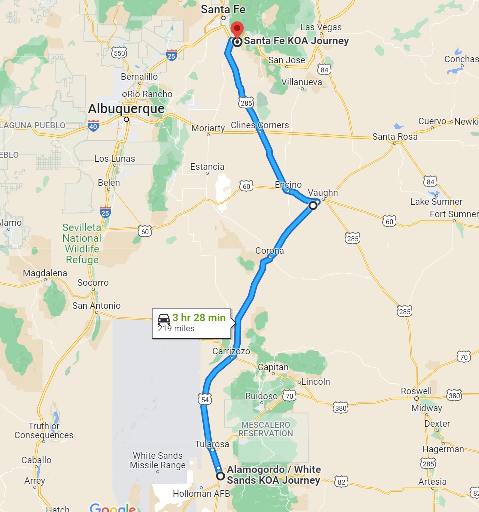
On May 5 we entered New Mexico north of El Paso on Highway 54, 202 miles beginning at Mt View RV Park in Van Horn, Texas ending at Alamogordo’s KOA. For more rustic camping, Oliver Lee Memorial State Park (which came recommended) and Dog Canyon dispersed camping next to it, are about 17 miles south of Alamogordo. There is nothing to see in Alamogordo except the New Mexico Museum of Space History, but it’s location was convenient for White Sands National Park.

In addition to White Sands National Park, we recommend a visit to Three Rivers Petroglyph Site and Valley of Fire Recreation Area north of Alamogordo. The mountain towns of Cloudcroft and Ruidoso are also worth a visit.

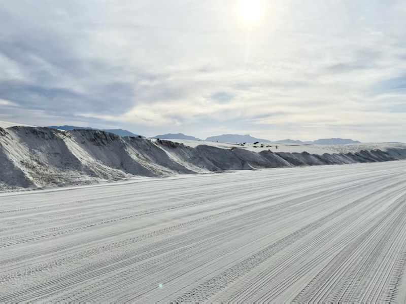
A 7 1/2 mile sand-plowed road takes you into White Sands National Park. There are plenty of pull-off parking areas from which you can walk into the dunes to your hearts content. 
The San Andres Mountains are a perfect backdrop for the gypsum sand dunes. 
Purple Verbena learn to grow quickly in this harsh wind-swept sand environment. 
Soaptree yucca plants punctuate the waves of sand. 
At Three Rivers Petroglyph, a trails leads to rock outcroppings that are covered with petroglyphs. 
Another well maintained trail takes you to the remains of a village. 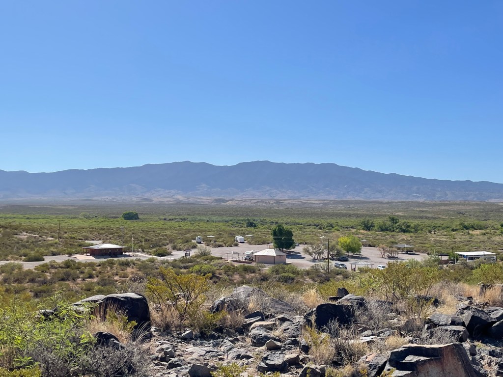
From the petroglyph trail, you can look down and see the parking area/campground, managed by BLM. 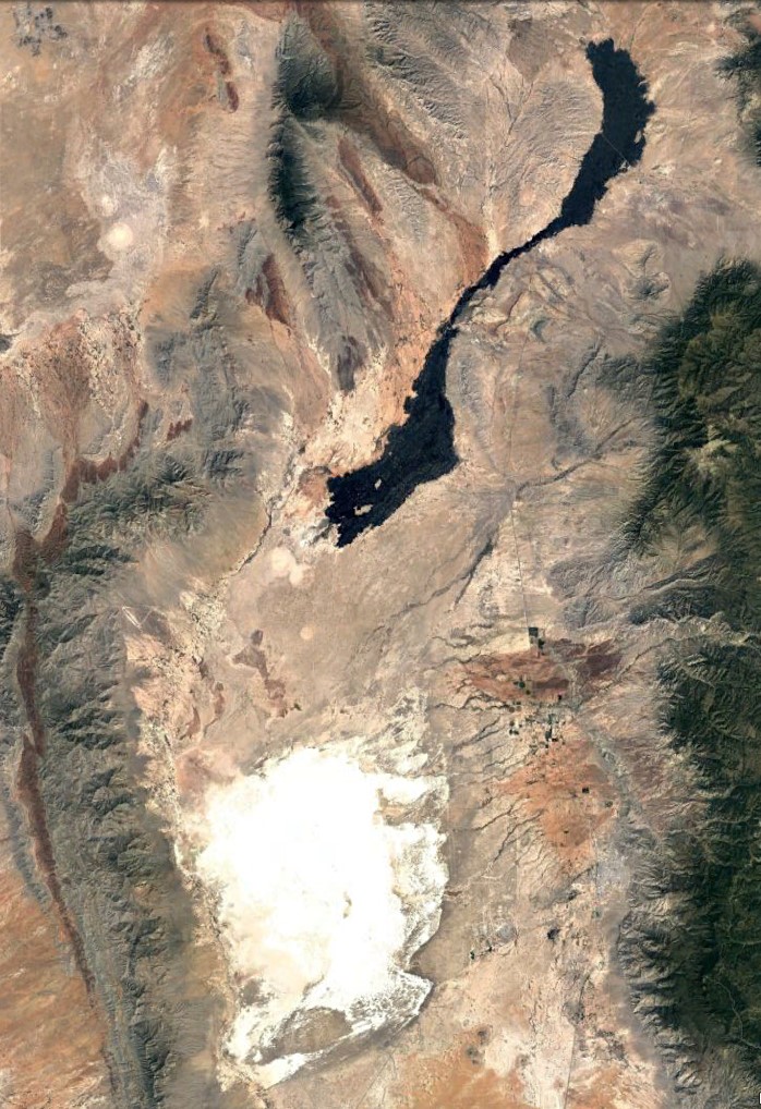
This satellite view shows a striking contrast between White Sands and the Carrizozo Lava Field. The Valley of Fire Recreation Area is part of the lava field, on the north end. 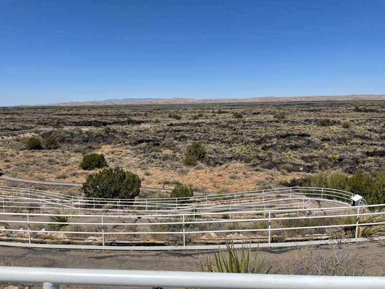
At the Valley of Fire Recreation Area, which is right off Highway 380, is a paved walking path that begins from an overlook of the lava fields and winds down into it. 
The overlook area contains a paved road leading to the BLM campground seen in the background. It is a very nice campground that accommodates big rigs. 
Along the lava field walking path, you can see the harsh landscape that is full of life. 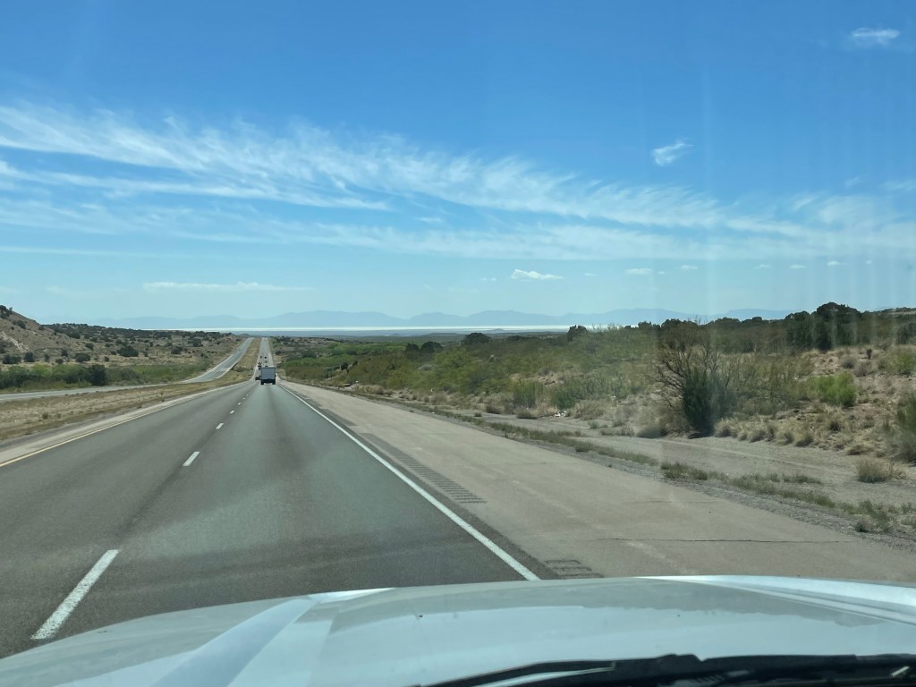
Highway 70 that passes White Sands National Park (you can see the dunes way off in the distance) looks much like most if not all the highways we drove while towing the RV around New Mexico. 
East of Valley of Fires Recreation Area and north of the town of Ruidoso is the Smokey Bear Historical Park. Who knew! Quite appropriate too as wildfires were raging across the Sacramento Mountains. 
Overlooking Alamogordo from the NM Museum of Space History. The museum was partially under renovation when we were there but still worth the visit. 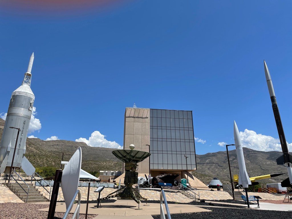

The first explosion of an atom bomb occurred July 16, 1945 on White Sands Missile Range, which is still in use by the way. The sand around the detonation site turned into a green substance called Trinitite. This is a replica of the Trinity Marker that was erected on site near Carrizozo. 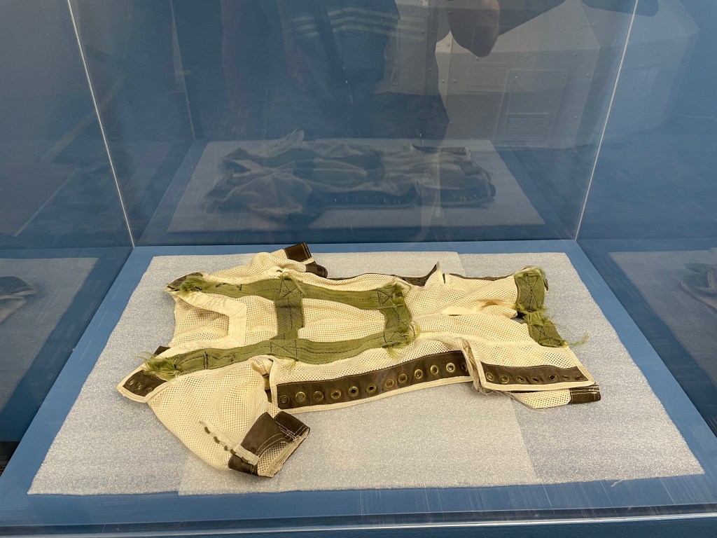
At the Space Museum, you can pay tribute to Ham the astrochip at his grave and view his space suit on display here.
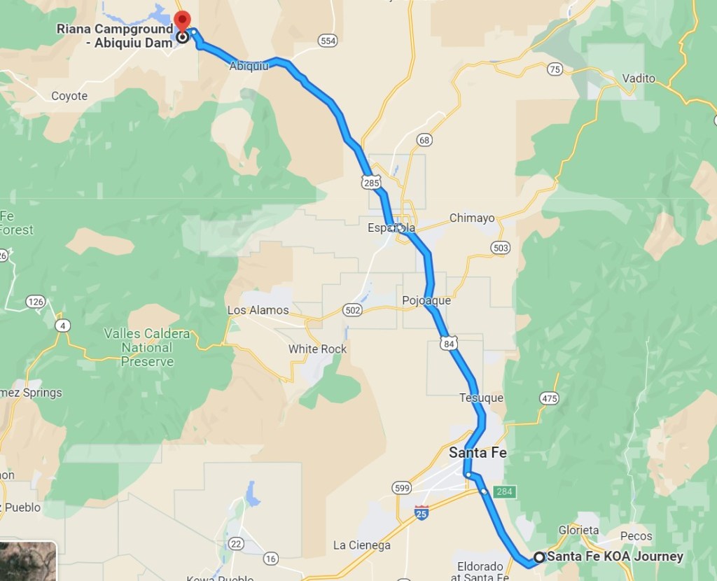
Santa Fe KOA – 4 nights
We left Alamogordo by way of Highway 54 to a small town called Vaughn. As we drove through it, I researched it to learn Vaughn was a railroad town complete with a Harvey House Hotel. Now, it is a known drug-smuggling route and patrolled by the county sheriff, New Mexico Rangers and State Police, Motor Transportation Police and Vaughn Police Dept. Probably much safer than it looked, Vaughn was a convenient diesel stop on our way to the Santa Fe KOA.
Four nights in Santa Fe gave us time to explore the area, including Pecos National Historic Park (highly recommended) hiking the Galisteo Basin Preserve, and walking downtown Santa Fe where we visited the Loretto Chapel and its ‘miraculous’ staircase and the New Mexico History Museum. Unfortunately, I did not acquire the necessary tickets in time for the Georgia O’Keeffe Museum which would have been the highlight of Santa Fe for us.


Pecos National Historical Park was our introduction to the ancient civilizations of the American southwest, being the first of several ruins we visited in New Mexico and Utah. 
The Spanish played a significant role in the lives of the Pueblo people. This is the remains and partially restored Spanish church. 


You can climb into some of the subterranean dwellings along the ruins trail. 
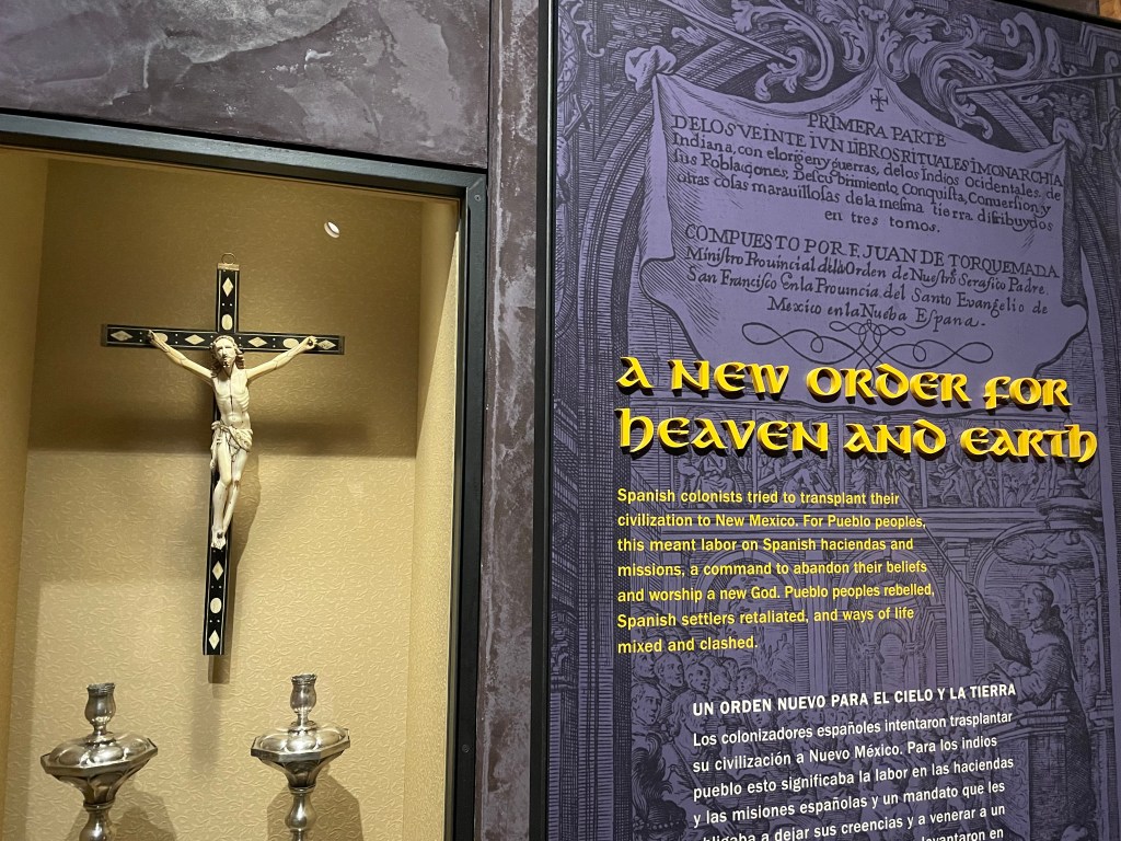
The New Mexico History Museum in downtown Santa Fe added greatly to our history lessons from Pecos National Park. 
A painting of the Franciscan martyrs, casualties during the Pueblo Revolt of 1680 against the Spanish occupation. 
Downtown Santa Fe with all its adobe charm. 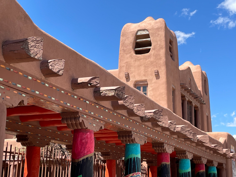
The whimsical adobe architecture is everywhere in Santa Fe. 
And so are the art galleries. 
On the corner of San Francisco St and Burro Alley. 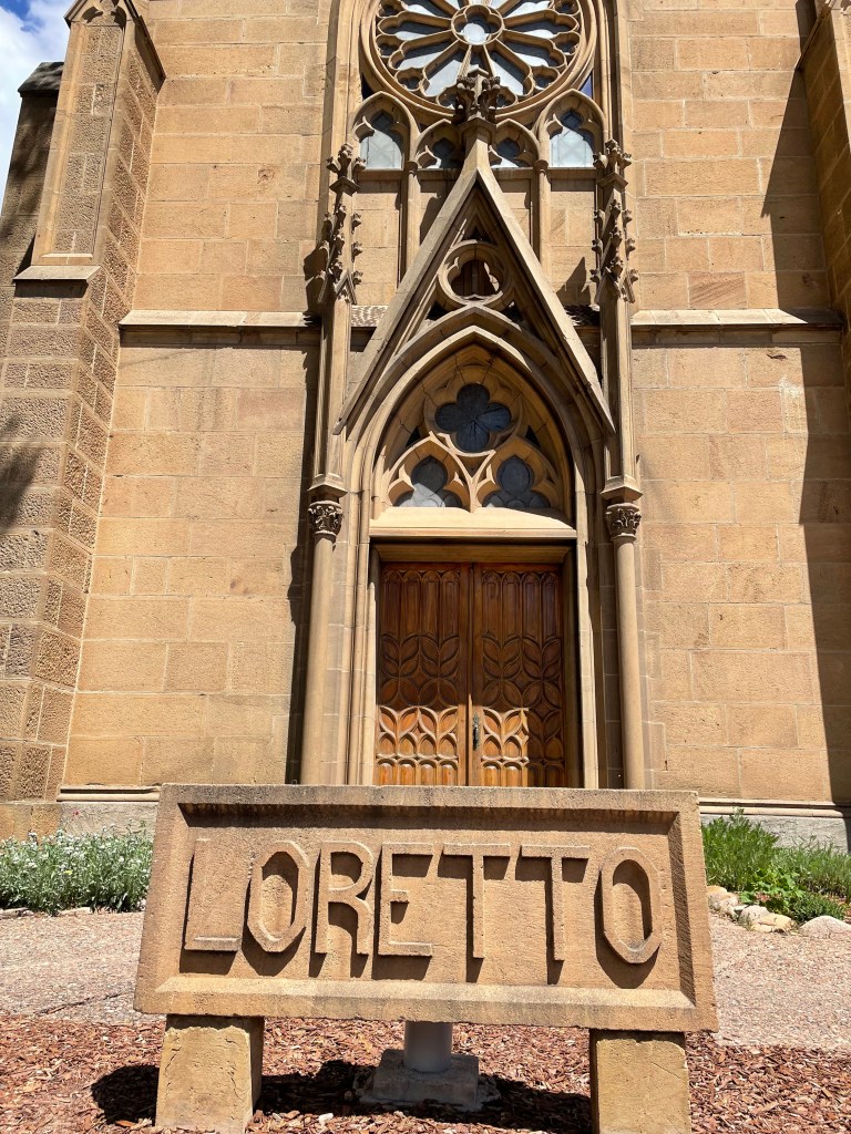
It is worth the 5$ to go inside the Loretto Chapel to see the ‘miraculous’ staircase. 
And now you’ve seen it! The miraculous staircase inside the chapel. 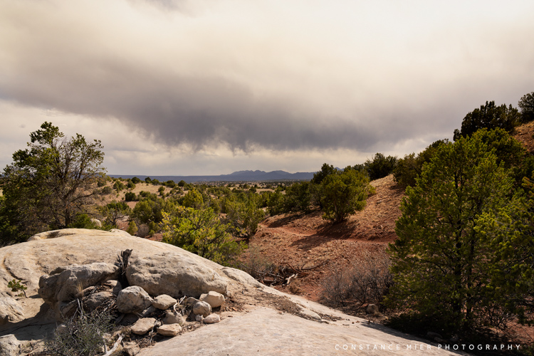
Before the storms, we had an pleasant hike with pleasant temperatures through the Galisteo Basin Preserve, about 9 miles from our campground. 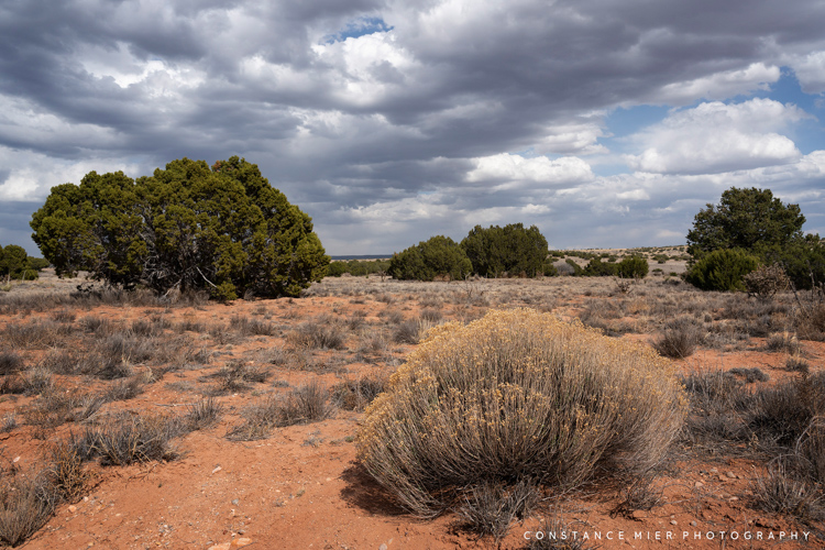
The desert basin. 
Riana Campground – 4 nights
After Santa Fe, we drove 70 miles north to an Army Corp of Engineers campground called Riana, located on the Abiquiu Reservoir. This was the only campground in our New Mexico itinerary where we wanted to spend quality time. Unfortunately, the water levels were so low that Vivian had to forego her kayak fishing plans.
Four nights at Riana gave us only three days to explore the area and explore we did. We wanted to see the following (distances are one-way from Riana):
Ghost Ranch – 8 miles. Purchasing a day pass for $10 allows you to hike the beautiful grounds where O’Keeffe painted many of her desert scenes and visit the museum. The entrance is conveniently located on Highway 84.
White Place (Plaza Blanca) – 10 miles. On private property, permission is needed to go in with a vehicle, park at the trailhead and hike around this wonderous landscape where O’Keeffee created her ‘White Place’ paintings. The entrance is on the outskirts of Abiquiu.
Georgia O’Keeffe Home and Studio – 8 miles. Museum in Abiquiu where the artist lived and worked (unfortunately closed at the time we were there due to Covid).
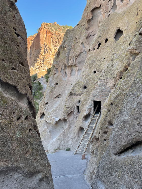
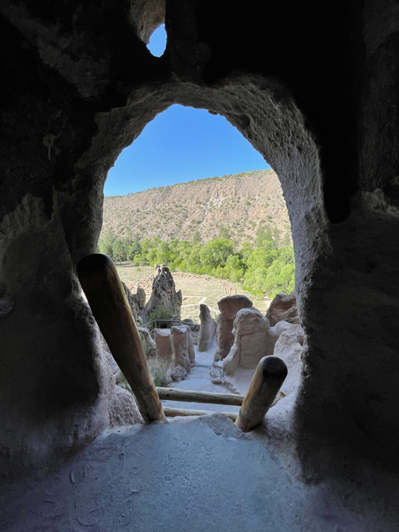
Bandelier National Monument – 59 miles. You cannot miss this, cliff-dwellings and petroglyphs in the beautiful Frijoles Creek Canyon. Easy hiking and beautiful scenic drive to get there.
Manhattan Project National Historic Park in Los Alamos – 48 miles. We visited Los Alamos after spending the morning in Bandelier National Monument. History buffs will love this place.


A view of our RV at the Riana campground, one of our favorite Army Corp of Engineers campgrounds. 
Each site is roomy with a paved driveway and gravel pad. This is standard for most Army Corp of Engineers campgrounds. 50AMP and on-site water hookups and a convenient dump station are typical. 
I could easily hike near the campground along the bluffs of the Abiquiu Reservoir. The flat top mountain in the background is Cerro Pedernal, famously painted by Georgia O’Keeffe and location of her ashes. 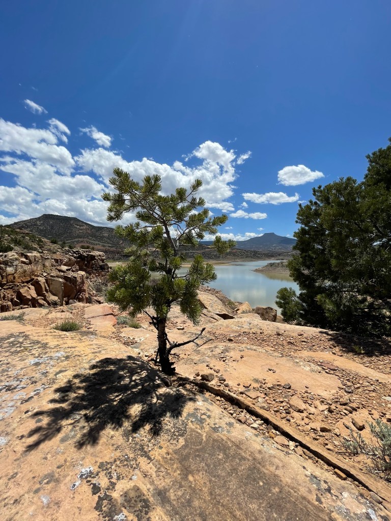

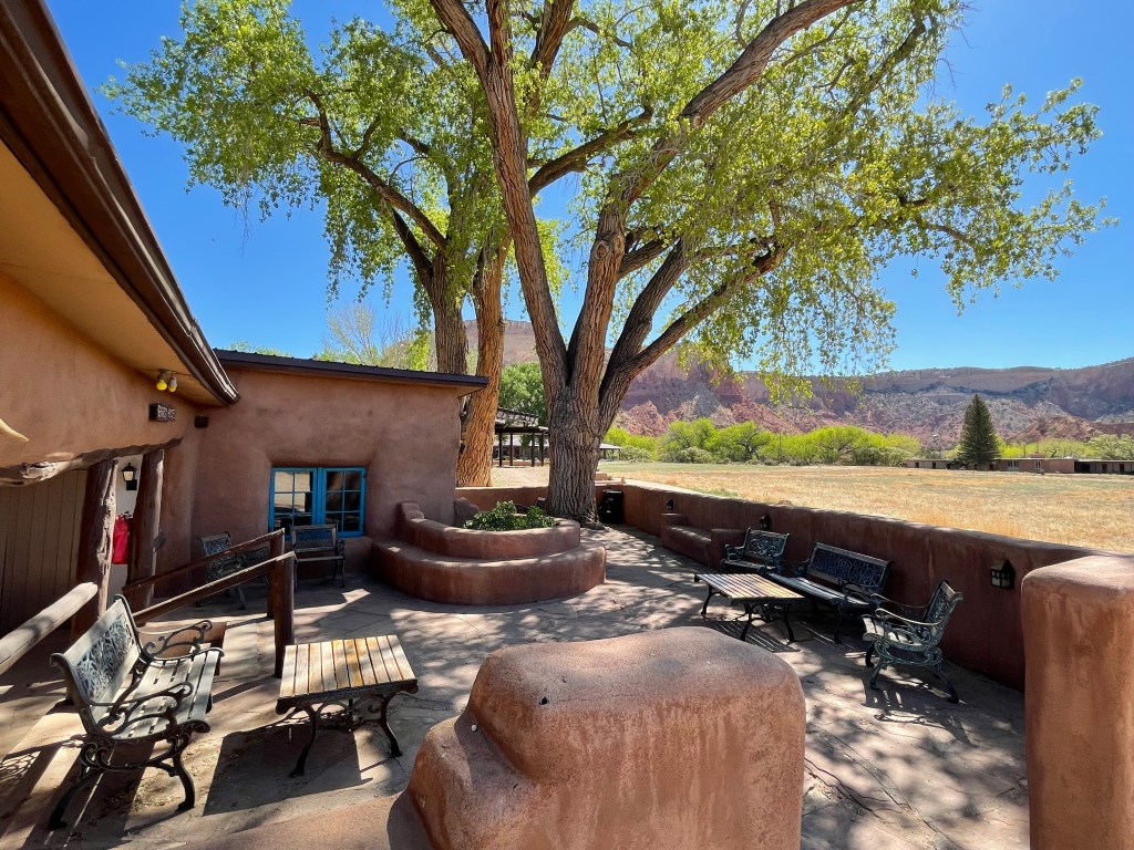
Not far from Riana is the Ghost Ranch where we spent the morning and afternoon. 
The short gravel road drive into Ghost Ranch has many scenic desert homestead scenes surrounded by beautiful red rock. 
Cottages can be rented at the Ghost Ranch. 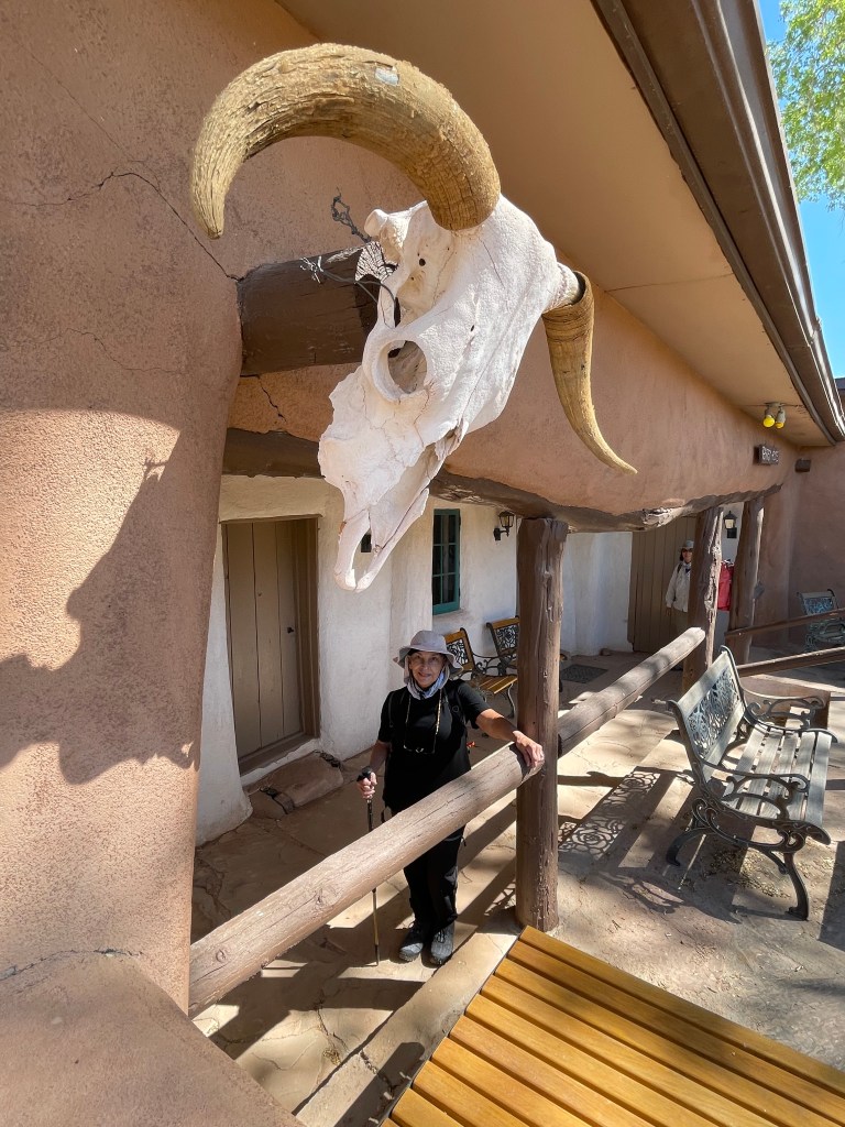
The classic longhorn skull that became a Georgia O’Keeffe icon is a common decorative motif at Ghost Ranch. 
The Ghost Ranch, where Georgia O’Keeffe lived and worked provides a retreat location for artists and students. 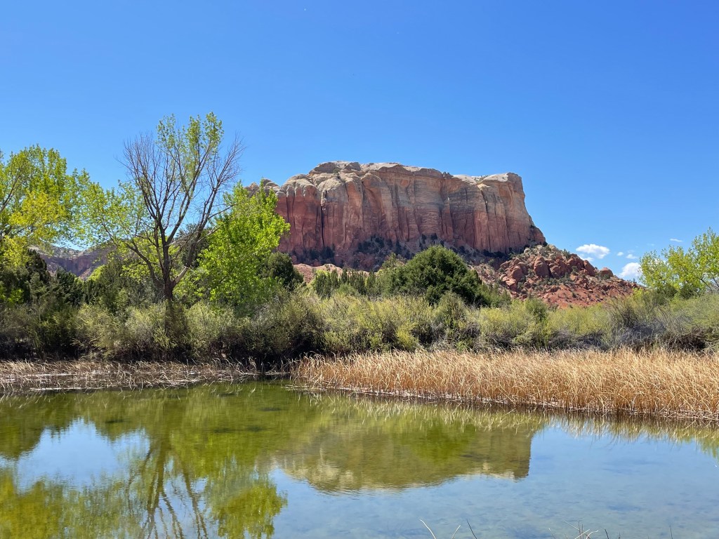
And there are beautiful hiking trails on the grounds of the Ghost Ranch. 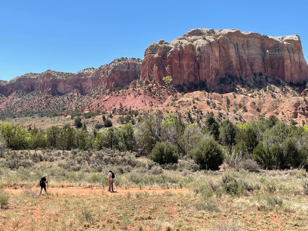
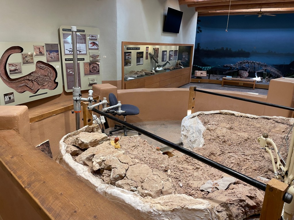
The Ghost Ranch museum houses a working paleontology lab. 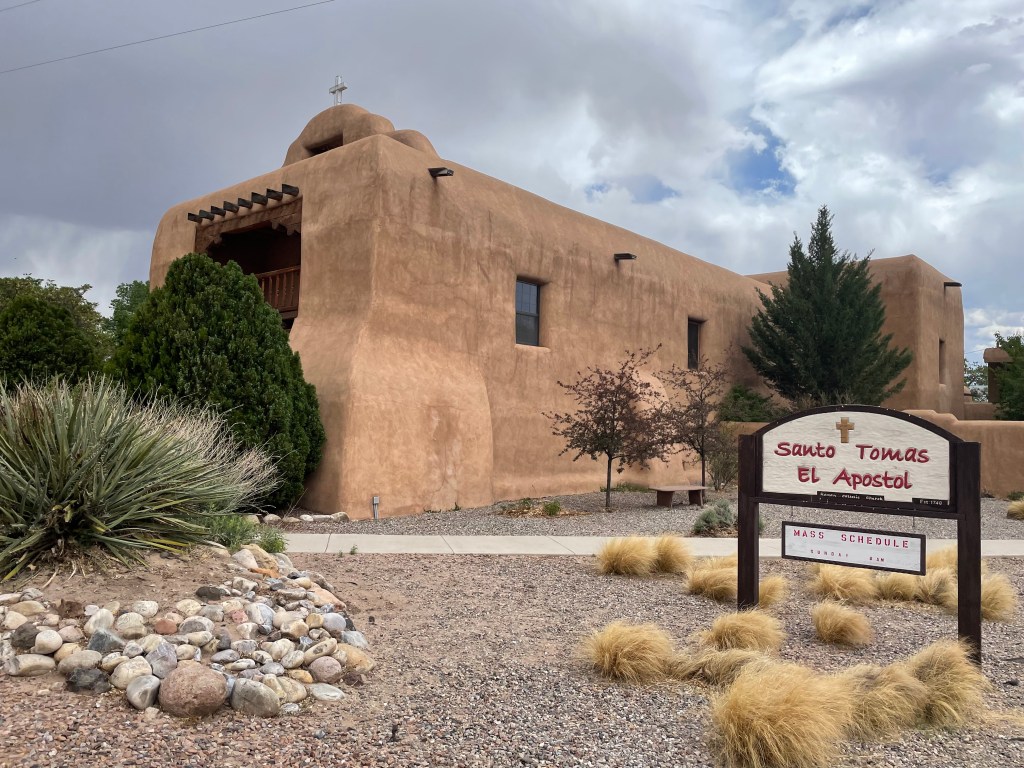
A church in Abiquiu, a small town near Riana and where Georgia O’Keeffe owned a home and studio. 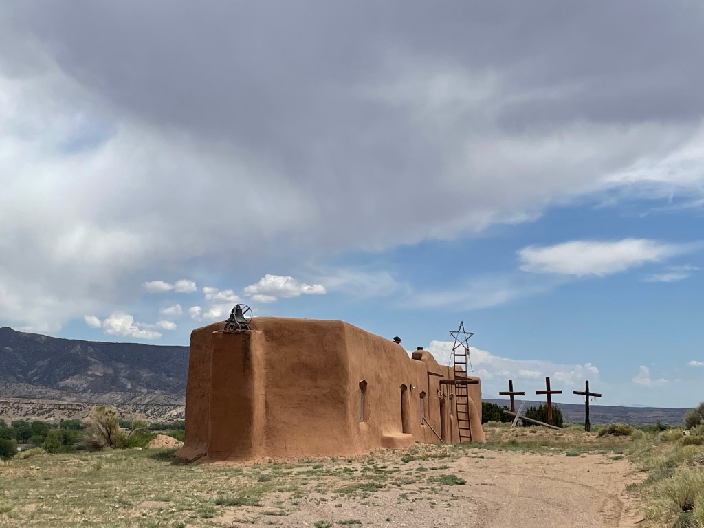
Penitente Morada in Abiquiu, originally built in the 1700s. 
Just outside of Abiquiu is the entrance to Plaza Blanca, land owned by the Dar Al Islam mosque and Islamic education center. 
With permission, you can access the road into Plaza Blanca, or what Georgia O’keeffe referred to as ‘The White Place’. 
Once inside, you can hike around in the canyons surrounded by gothic cathedral like rocks. 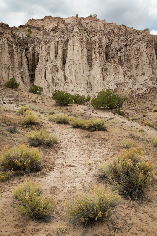

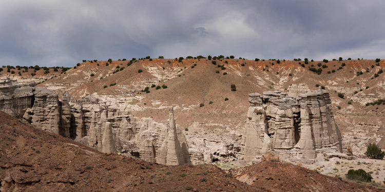
An amazing place! 
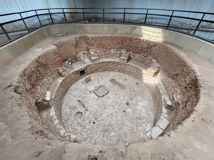
While camped at Riana, we drove to Bandelier National Monument and got there early before the crowds. Here you can walk in and around the ancient ruins and cliff dwellings. 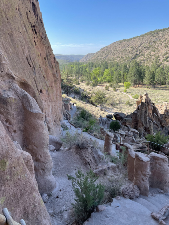


After visiting Bandelier, we drove to Los Alamos. This city park is part of the Manhattan Project National Historical Park. 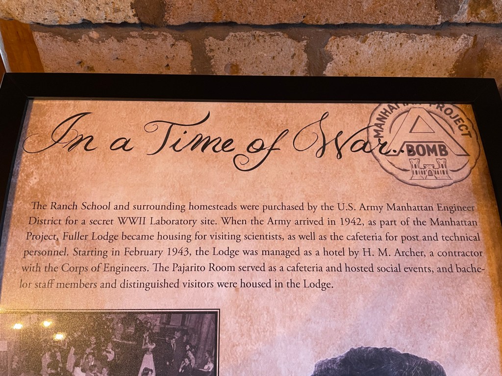
At the park, we came to the Ranch School where J. Robert Oppenheimer and many others involved with the Manhattan Project lived. 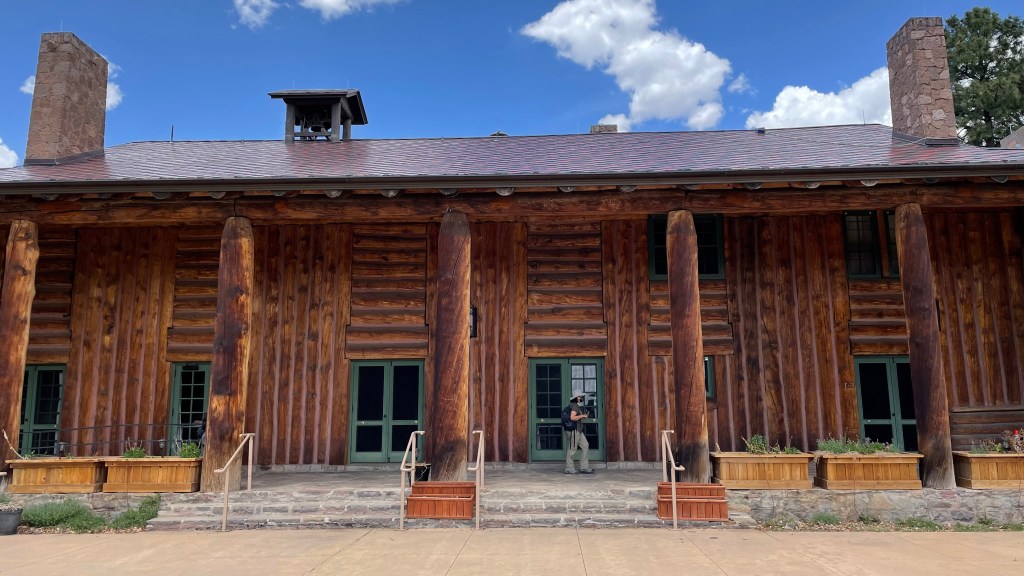
What was once a Ranch School for privileged boys became the home and meeting location for nuclear engineers and many others tasked with creating the first atomic bomb. 
Imagine the brain power that filled these rooms. 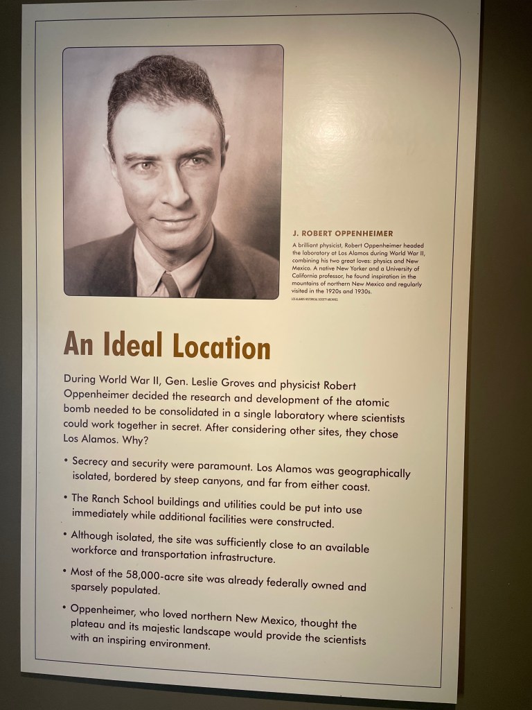
An isolated but inspiring, and secret location. 
Events leading to this outcome are poignantly described at the park’s museum. 
A roadside view of the Rio Chama from Highway 84 near Abiquiu.
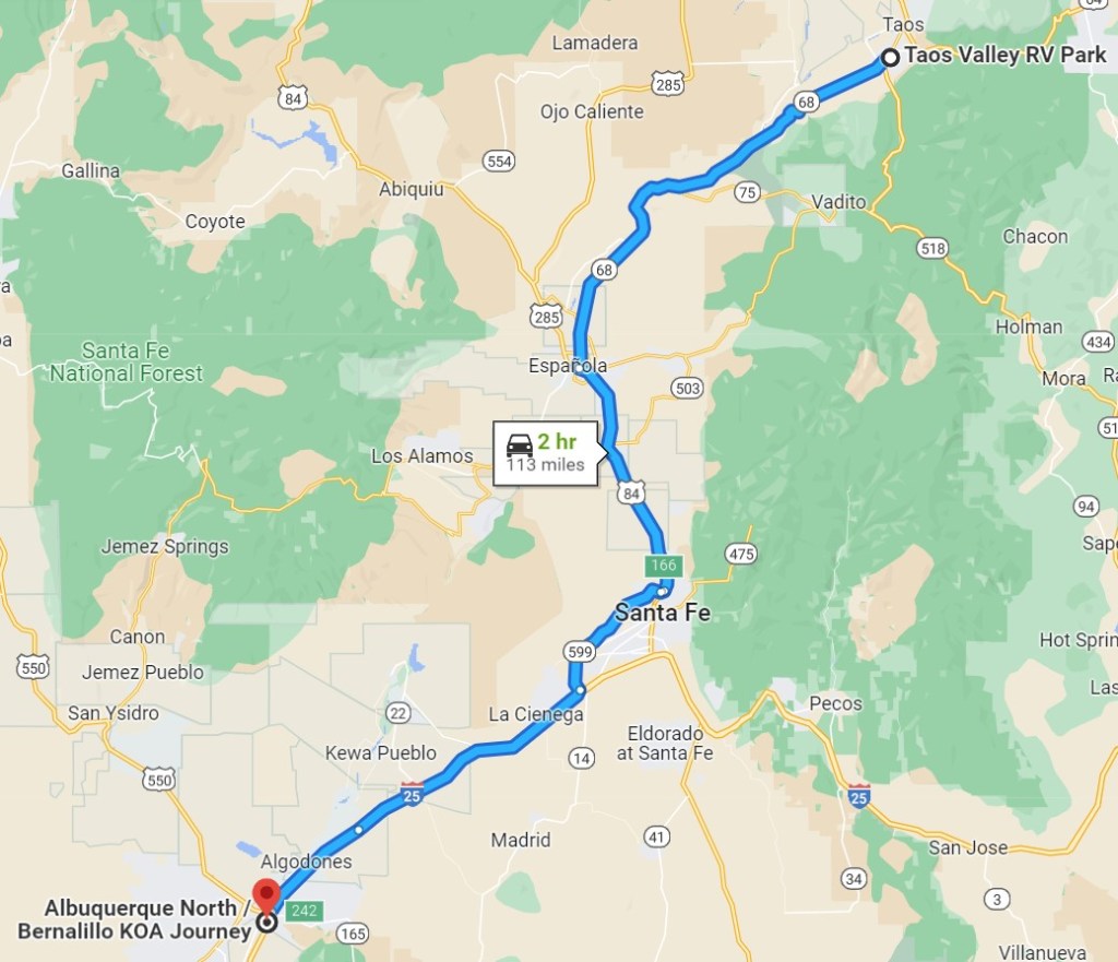
Taos Valley RV Park – 3 nights
Another short distance of towing, 67 miles brought us to the Taos Valley RV Park. With only 3 nights and one and half days of non-stop rain, we had little time to walk downtown Taos (Taos Pueblo was closed due to Covid) and drive over to the Rio Grande River Gorge.


The Gorge Bridge is about 600 feet above the Rio Grande. 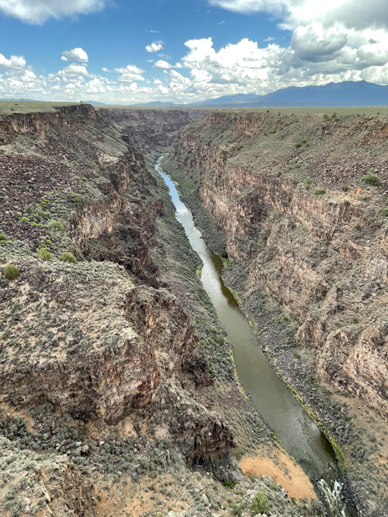

An unfortunate necessity. 
Started in 1963, the bridge was completed in 1965. 
It is one of the highest bridges in the U.S. 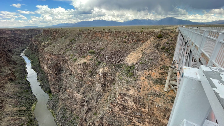

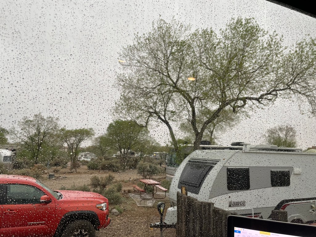
The day long view of Taos Valley RV Park on our second day. 
Once the rain cleared, we took a late afternoon drive to see the views from Highway 68.
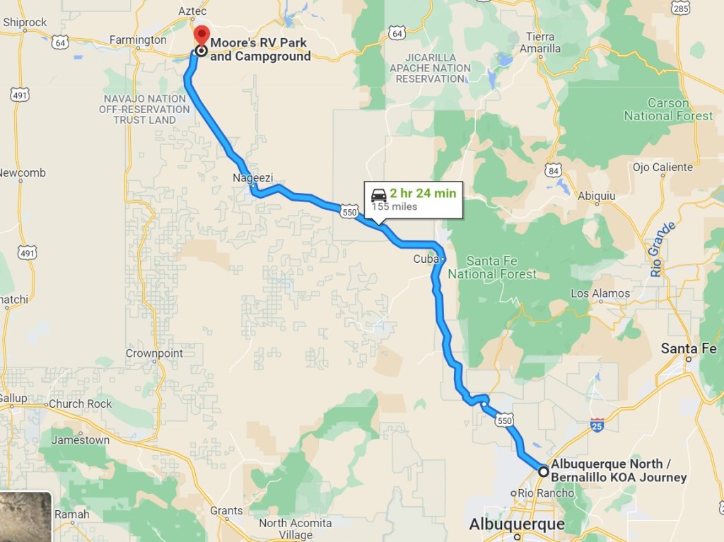
Moore’s RV Park and Campground – 7 nights
Our final stop in New Mexico before entering Utah was Moore’s RV Park and Campground in Bloomington. From Taos, we stopped over at the Albuquerque North/Bernalillo KOA for one night before heading north on Highway 550.
Bloomington would be our home for one week, but we spent very little time there as we had many places to visit and explore including the following (miles are one way from campground):
San Juan River near Navajo Lake State Park – 25 miles. Beautiful river scenery and lots of fly fishermen.
Mesa Verde National Park – 80 miles. One of the country’s best national parks. Although a long drive for us, it was well worth it for the spectacular views along the way.
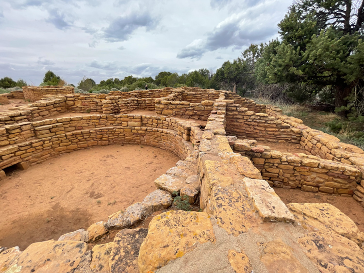
Aztec Ruins National Monument – 10 miles. In the town of Farmington, it is a relatively small park but well worth the time to walk the ruins, about 1 hr.
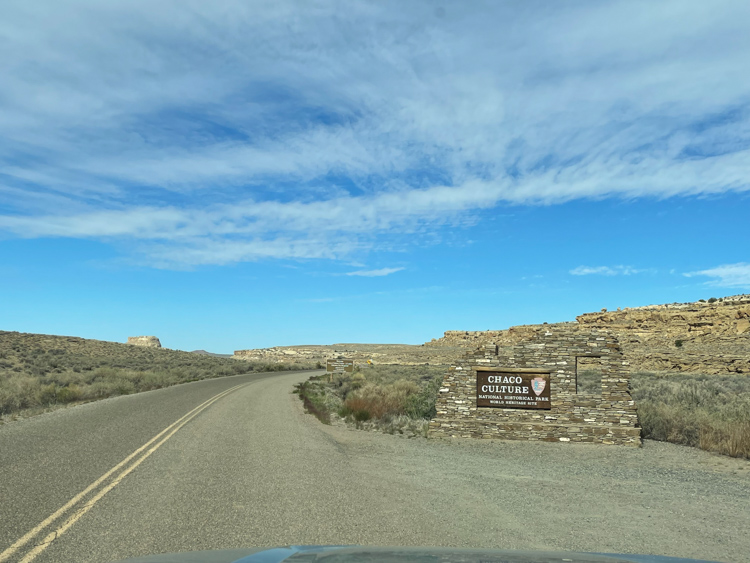
Chaco Culture National Historical Park – 62 miles. To get there, you must take the long, torturous gravel road. It took as over two hours to drive there, but definitely worth it! You can spend an entire day wandering around the ruins.
The Lybrook Badlands and Black Place – 52 miles. We hired Navajo Tours USA to take us into the Lybrook badlands one afternoon and glad we did. The badland areas, including the Bisti/De-Na-Zin Wilderness area are accessible on public lands but a 4-wheel drive, navigational knowledge of the area and attention to weather (roads becoming impassable due to rain) are essential if you really want to get in there and see it. For a shorter version, the Bisti wilderness can be easily accessed from a parking area not far from Highway 371 and an easy hike in allows you to see the badlands up close.
It is difficult to imagine a large city where thousands once lived in this now barren land. 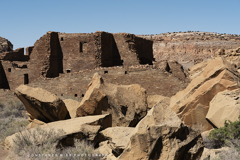
Large boulders lay strewn around the Chaco ruins, evidence of an archeological blunder that occurred decades ago. 
The ancient structures in Chaco Canyon are breathtaking. 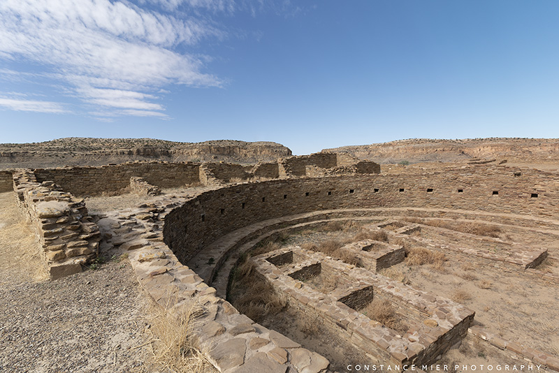

The washboard gravel road to Chaco Cultural National Historical Park is a long one. We learned it is not maintained to keep looters and vandals out. 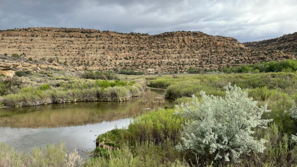
The San Juan River near Navajo Lake State Park is a short drive from Bloomington where we parked the RV for a week. 
We spent a couple mornings here so Vivian could do a little fly fishing. 
This area of the San Juan is popular for fly fishing. 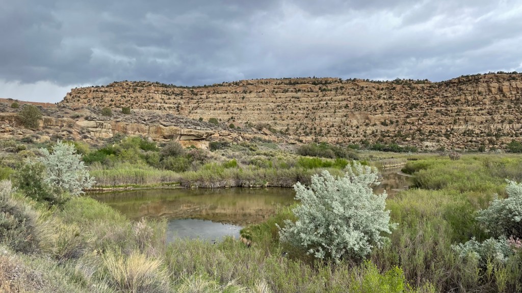

The Navajo Dam is in the background and you can barely make out the road that crosses it. 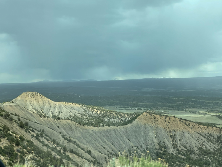
Although Mesa Verde National Park is in Colorado, I include it here because we drove to it from Bloomington, NM. The drive there was spectacular. 


One of the many views of the cliff dwellings in Mesa Verde. 

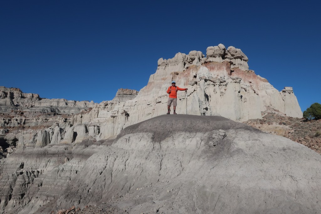
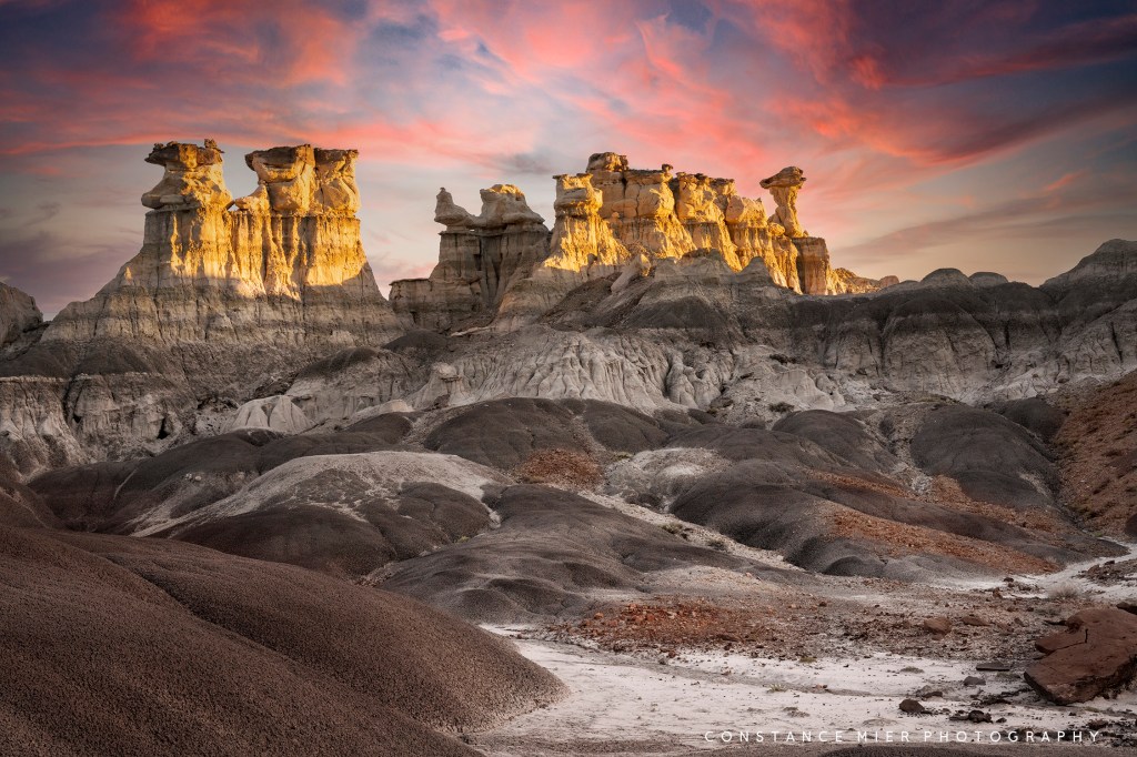
We hired Kiahlo of Navajo Tours USA to take us into the Lybrook Badlands. 
He guided me to some wonderful locations to photograph. 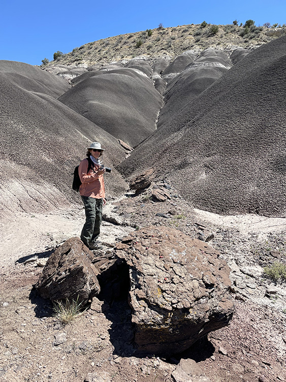
Including this one which is from Georgia O’Keeffe’s ‘Black Place’. She was photographed sitting on that same rock you see here in the foreground. 
Hiking among the badland hoodoos. 
Georgia O’Keeffe’s Black Place through my lens. 
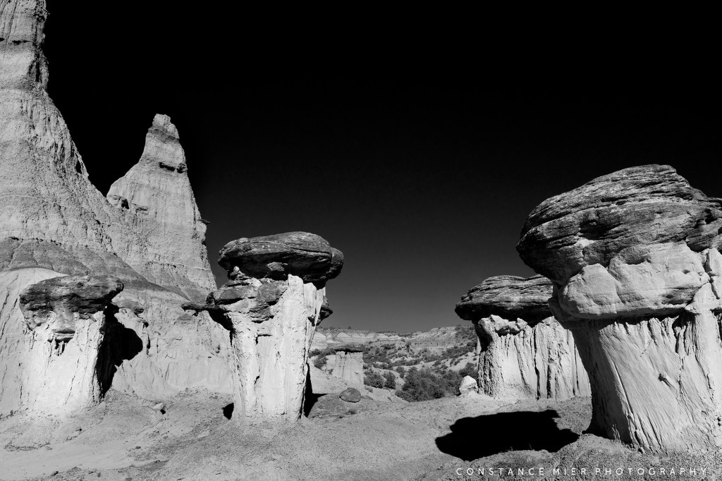
The hoodoos of Lybrook badlands. 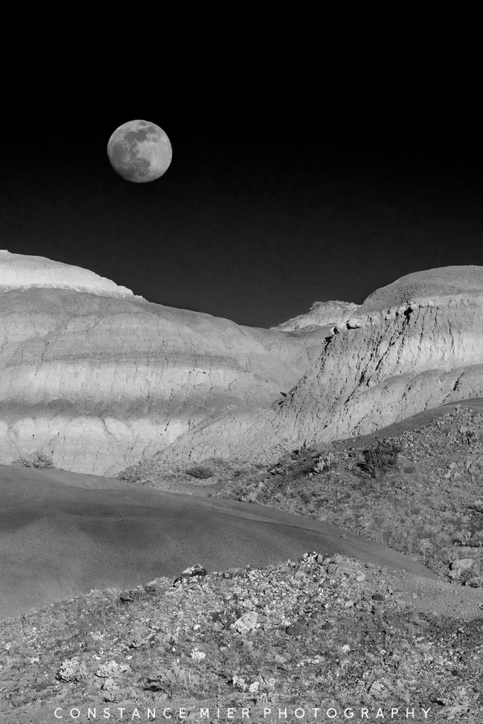
Last but not least, check out my previous blogs for a little history and perspectives on New Mexico:
Gateway to the Southwest, May 8, 2021
