Traveling America’s southwest makes one want to be a geologist. While researching and preparing for our 2021 travels, we found Google’s satellite imagery of the areas of Utah and New Mexico most intriguing. Our desire to explore certain areas was heightened by aerial views of abstract terrains made of colors and contrasts. These strange lands piqued our imaginations. Our introduction to these mysterious lands of the southwest began in southern New Mexico where white sand and black basalt lava meet.
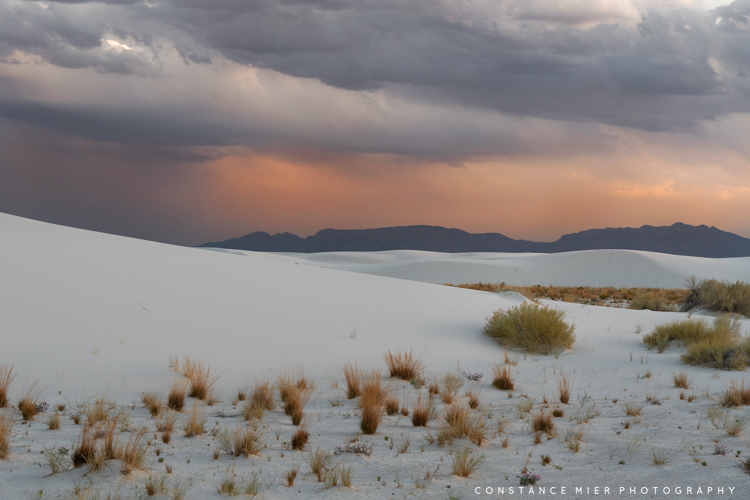
Much of the planning was done by me and not Vivian. While White Sands National Park was at the top of my list when I made reservations for a campsite in Alamogordo, I also made time between visits to White Sands to explore two other locations far removed from the dunes, at least by appearances. But first, White Sands. A satellite image gives you a good idea as to how massive the white sand dunes are and NASA’s imagery provides details of this 275 square-foot landscape anomaly, the largest gypsum dune field on Earth.
As we continued to explore national monuments and parks, we learn what is common among many of them is preservation began with one person’s foresight. To be considered by the National Park Service as a prospective site, it required “economic worthlessness and monumentalism”. More importantly, it requires someone to lead the way with enthusiastic support for the idea. The economic worthlessness was an easy sell given that mining the gypsum sand dunes proved unsuccessful due to low market value of unprocessed gypsum sand. In the 1920’s, people began to see the value of the dunes for its uniqueness and this view was brought forth by Tom Charles of Alamogordo to the park service. His efforts paid off.


On January 18, 1933, President Herbert Hoover established White Sands as a National Monument to preserve “the white sands and additional features of scenic, scientific, and educational interest.” As you may know, national monuments can come and go depending on who resides in the White House, but national parks are created (or removed) by a majority vote by Congress. In other words, once a monument becomes a national park, it is pretty much there to stay to eternity. On December 20, 2019, White Sands was designated as a National Park in recognition of its added significance of the park for its natural and cultural resources. It receives over 600,000 visitors each year and is the most visited NPS site in New Mexico (even before becoming a national park).
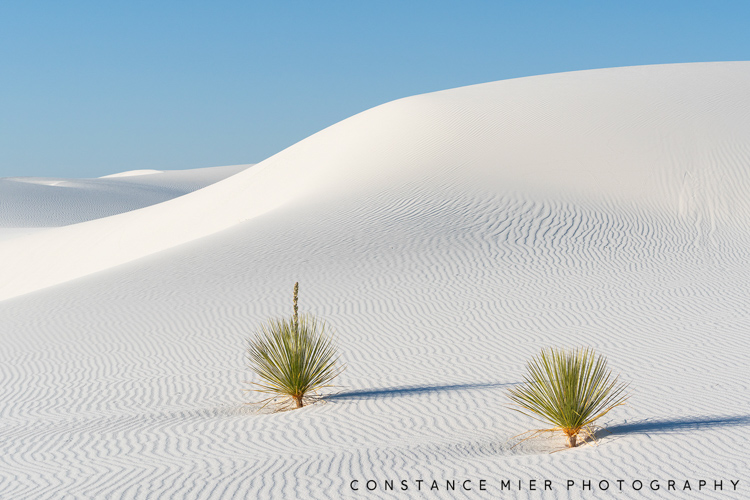
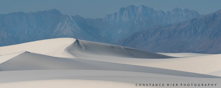
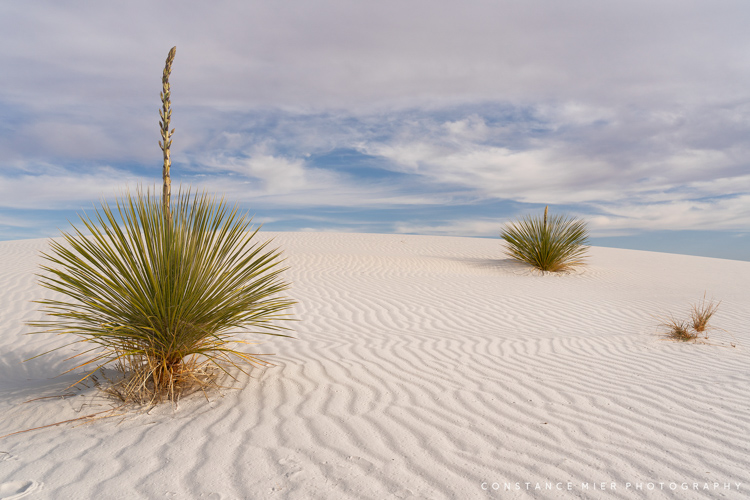
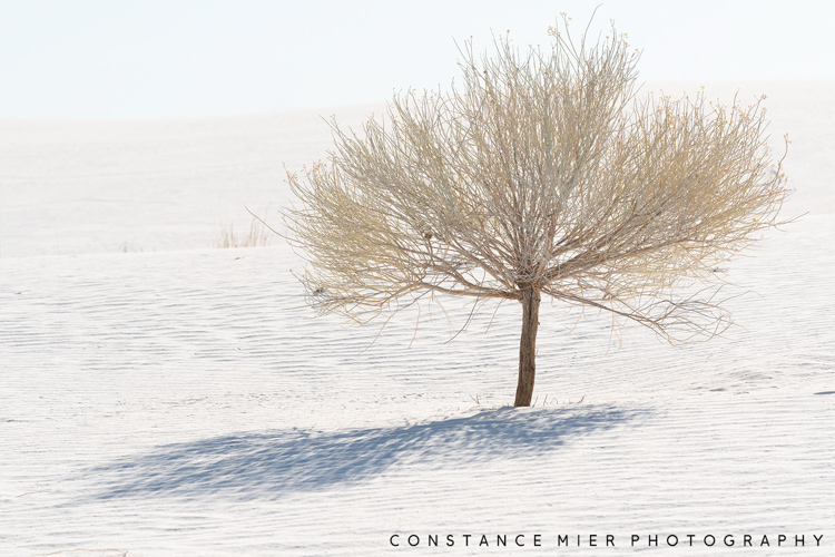
White Sands Dune Field was formed when sea levels that once covered the area dropped, leaving behind gypsum sand, a soft mineral that dissolves in water. This process began as water washed down from the newly formed San Andres and Sacramento Mountains into the Tularosa Basin forming a shallow sea. With nowhere to go, the water evaporated over time leaving behind massive quantities of gypsum crystal deposits that eventually broke down into tiny grains that formed dunes as high as 60 feet. This is what is now 145,762 acres of national park.
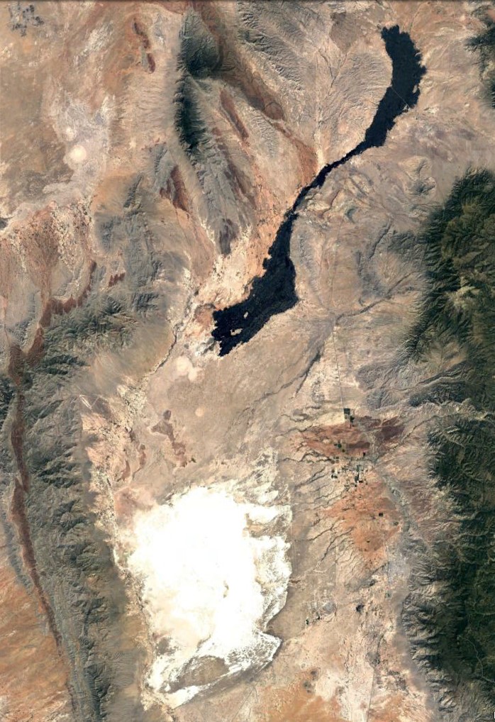
Given the amount of sand included in our itinerary, I knew our stay here would not be a fishing location for Vivian. And therefore, I never discussed the details of my planned itinerary except to say I wanted to spend lots of quality time photographing White Sands. Because sand is Vivian’s least favorite thing in the world, she visited White Sands one time with me only to say she saw it, and happily stayed back when I returned to the dunes a couple more times. But we had other places to visit during our short stay. So, while I photographed dunes, Vivian began researching the other locations on our itinerary. Upon looking at a Google satellite image, she noticed a large dark area just north of White Sand and got excited at the prospects of a body of water.
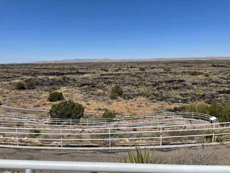
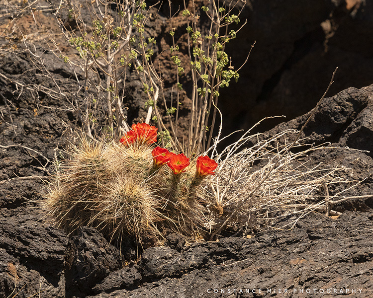
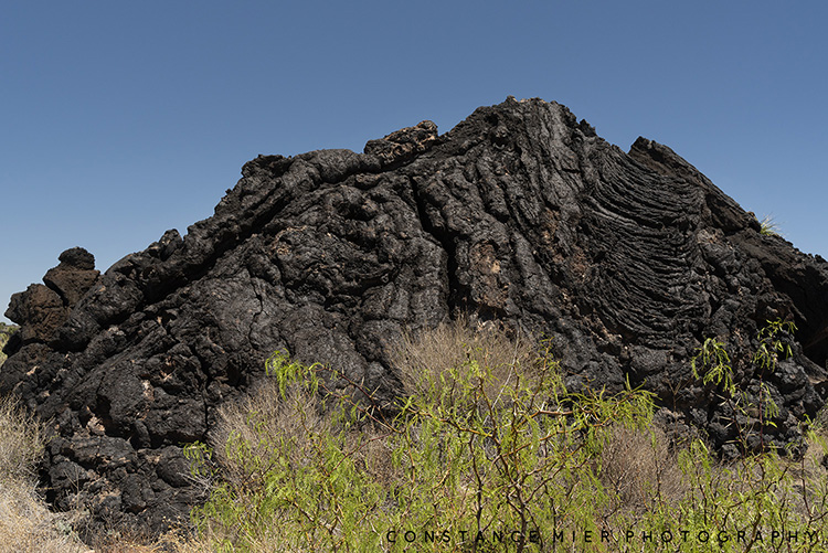
Unfortunately for Vivian, that body of water was not water at all, in fact it is quite the opposite. Seeing the disappointment on her face as I told her to put away her fishing gear for now, I explained that the large black area on the satellite map was something extraordinary because I knew her disappointment would be replaced by curiosity and a fascination for exploring the unknown. Only fifteen miles north of the brilliant white gypsum deposit is a 47 mile-long charcoal scar in the arid landscape of southern New Mexico. The Carrizozo Malpais, a huge lava flow resulting from the eruption of Little Black Peak, is 4-6 miles wide, 160 ft deep and covers 125 square miles. The uniform dark appearance comes from the basalt content, which tended to flow easily, thus creating an elongated lava landscape within the Tularosa Basin. Geologists believe the Carrizozo was created in a single episode lasting 20 to 30 years about 5200 years ago, making it one of the youngest lava flows in the U.S. It is also about 5000 years younger than the White Sands Dunes.

The lava flow is called Valley of Fires and is managed by the Bureau of Land Management. A campground overlooks the lava flow and a well-maintained walking path winds through the lava flow. Surprisingly, the Valley of Fires is full of life. The black basalt is practically covered with plant life and is inhabited by many animals including bats, mule deer and cottontail. Bird watchers come here to see the great horned owl, burrowing owl, sparrows and the golden eagle among others.
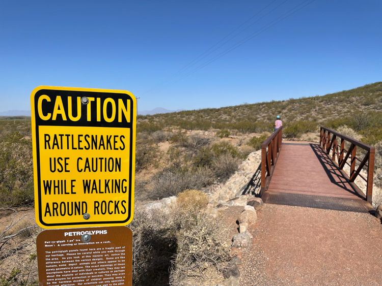
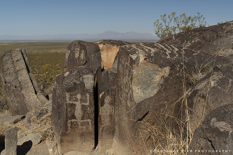
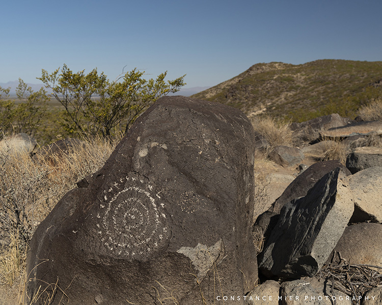
White Sands National Park and Valley of Fires represent the two extremes of the Tularosa Basin. Nevertheless, the basin has been inhabited by people for thousands of years. And a short distance south of the Valley of Fires is another interesting area managed by BLM where you can see evidence of people who lived there between 900 and 1400 AD. Three Rivers Petroglyphs is an amazing display of ancient rock art, containing over 21,000 petroglyphs. It is one of the largest rock art sites in the southwest. Visitors can see many of these petroglyphs on a 1/2mile long trail along a ridge where large rocks carved with faces, animals, handprints and sunbursts can be viewed up close.

All in one day, we explored two extremes of landscapes of the Tularosa Basin and an area where three rivers came together to provide people a hospitable environment to live. All this thanks to Google Maps.
Enjoy this slideshow of more images from the three amazing locations we visited (and an additional photo from the mountain town of Riudoso) while staying in Alamogordo.


I really enjoyed this “Petroglyph” of your travels through New Mexico. We loved our time there. It was one of the most memorable sights of our travels. I didn’t realize Vivian hated sand so much! I hope you at least took her through the drive-thru at McDonalds for a fish sandwich!!
LikeLike