
The summer of 2020 was a strange time to travel through the red and blue United States. Beyond doing what a pandemic normally does, COVID-19 also managed to saturate those red and blue tones creating an even more distinct dichotomy within the United States. We became poignantly aware of the differences as we traveled through many states that did not impose state-wide mandates to mitigate the spread of the virus. This is not an endorsement of either side of the political spectrum; rather, it is only our observation. In much of these areas, people went about their normal lives, until of course they got sick. But, these states had something going for them – fewer people and plenty of wide open space. And that is where we wanted to be.
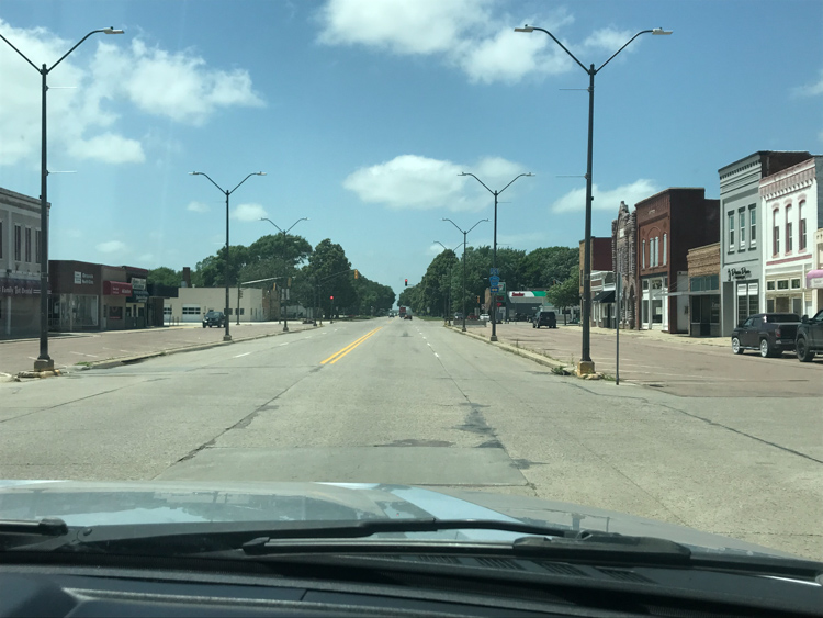
So, it was no surprise to see a hand-written sign stating “Masks not required” on the door of Onawa, Iowa’s only grocery store. Shortly after setting up our campsite at the Lewis and Clark State Park, we drove a few miles to the little town to pick up some groceries. Known for having the widest main street in the continental United States, Onawa was where the Eskimo Pie was created in 1920 by Chris Nelson who owned an ice cream shop. During World War II, Onawa was the site of a prisoner-of-war camp between 1944 and 46. I am not sure how that came to be, given that no more than 50 POWs lived there at any given time while a nearby town, Algona contained 10 times as many prisoners.
Despite its few distinctions, Onawa looks like most rural farm towns in Midwest America, run down with a modest amount of humble pride. Our impression of rural life was not improved after picking up the “Grapevine – Your Hometown Newspaper” where pictures of smiling Onawa High School graduates were displayed. Our thoughts on these young individuals’ futures were overshadowed by the ad pages that were not much more than a list of announcements for alcoholics, narcotics and emotions anonymous meetings, and free counseling for domestic violence or sexual assault victims.
Ranked #1 in soybean, corn, pork, and egg production, more than 85% of Iowa’s land is farmed. Iowa farms have had their share of bad times, not the least of which is COVID-19. If the virus was not bad enough, the August 2020 Derecho winds dealt another blow across the state destroying many homes and businesses. While the Great Depression left a lasting impression in Iowa including a major population decline, the farm crisis in 1983 was just as devastating. During that year, an average of 500 farms were auctioned per month. With all that, I can understand a little better why the only grocery store in Onawa, Iowa did not have a mask requirement. These people have survived worse times, so an invisible virus was not going to keep them from a normal life.
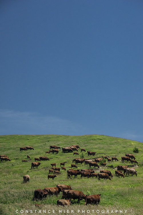
Iowa is the only state whose east and west borders are formed entirely by rivers, the Mississippi to the east and the Missouri comprising most of the west border. The Missouri River symbolizes the gateway to the Great Plains and Iowa was our introduction to what lay beyond the western banks of the longest river in the United States. Awaiting us were endless gentle slopes of green, speckled with cattle and interrupted by spectacular red buttes and canyons. But first, we had some exploring to do on the east side of the Missouri.
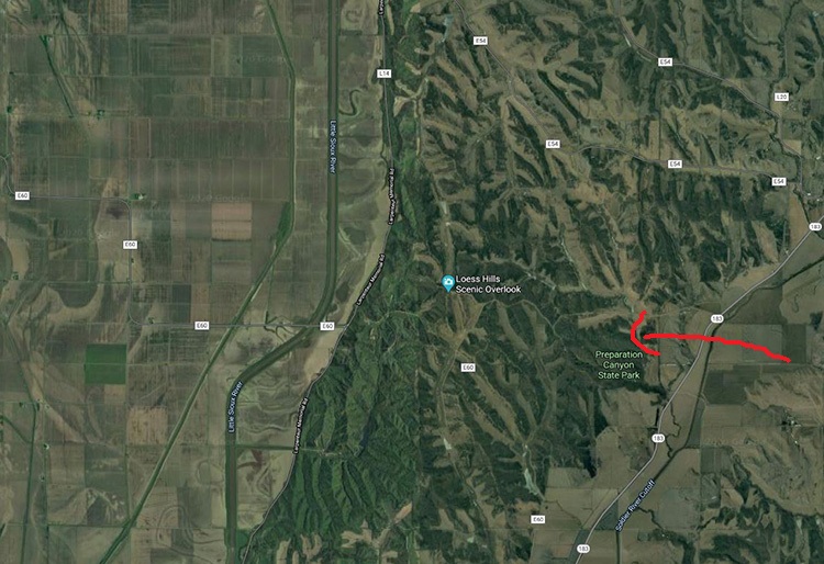
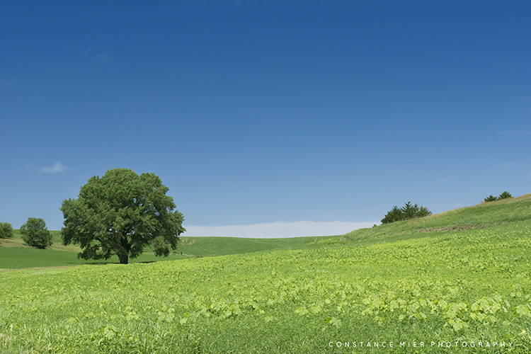
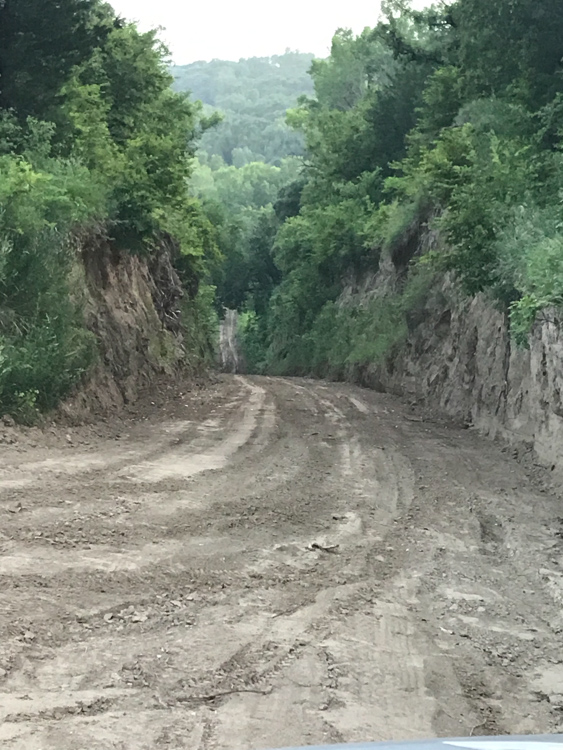
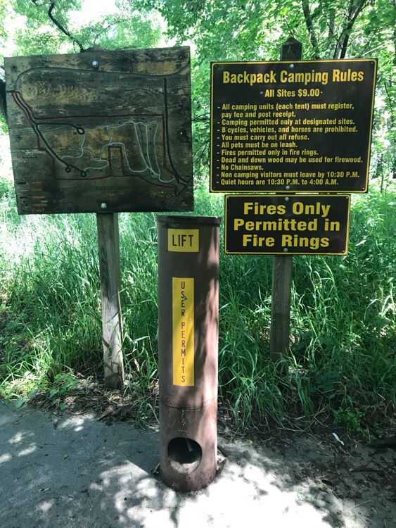
What really brought us to this area was the Loess (pronounced ‘Luss’) Hills. Where northeastern Iowa is characterized by a landscape unaffected by the drift of glaciers, this western part of Iowa has much evidence of glacier-driven formation. Glacier movement grinds rock into silt. Over time, wind deposited the silt along the eastern edge of the Missouri River. The accumulation of wind-blown silt, or loess is what we see today as the Loess Hills, a rare and distinct landscape of flowing green and forested hills. We set out to explore the Loess Hills on the hiking trails within Preparation Canyon State Park. This park got its name from a former community called Preparation, established in the 1850s by Charles B Thompson and his band of followers. The Great Mormon Migration toward the Utah territory began in 1847 and lasted 20 years. Thompson’s group was a small one among the 60,000 Mormons who fled persecution in Illinois.


At some point along the way, Thompson received a message from the “Spirit”. Given the extreme hardships that came with westward migrations, I am guessing he was pretty much over it before arriving at the Great Plains and recognized the area as having good potential for farming. Indeed, the area was known as “Monona”, an Indian name for “Peaceful Valley. As a result of the spirit message received by Thompson, he and 50 or 60 families following him bailed from their wagon trains and organized the town called “Preparation”. This name was an easy one to come by because of their belief that existence in life was merely a preparation for the world to come.

Things were going quite well as the Mormons realized they settled in one of the richest farming valleys in the area. So Thompson did what any corrupt leader would do when in control of the town’s newspaper, he printed the following message written by his imaginary spirit he called ‘Beneemy’, “I appoint Charles B Thompson chief steward of my house to receive, hold, manage and direct all the treasures of my house to him.” Well, people believed Thompson’s fake news and consequently, turned over deeds and all possessions to their leader.

Not all was peaceful in Peaceful Valley. Thompson’s people eventually wised up and asked him to return their property. This led to a hot dispute which eventually ended in the Iowa Supreme Court. Before that though, angry people organized a lynch mob and when Thompson got wind of that, he fled the state. People got their property back and for a long time thereafter, Preparation flourished. It even had a skating rink at one time. But after the Thompson sham, many discouraged Mormons left the valley and headed out to Utah. By 1946 the town was pretty much deserted. Descendants of the original Mormons eventually sold the land to Iowa.

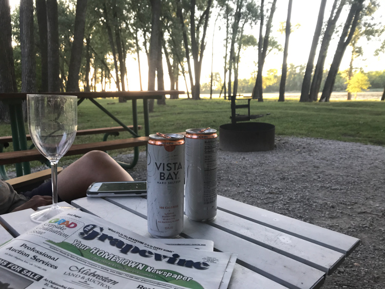
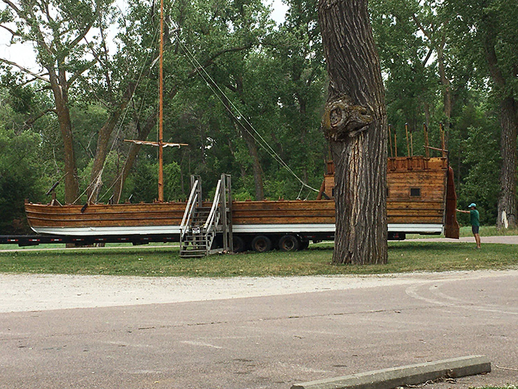
I remember the lovely green pastures, rolling forested hills and hidden ponds of the Loess Hills, but what stands out the most is the relentless daily temperatures above 90 degrees during our 4-day visit. On our last day, we got a reprieve from the heat by visiting the state park’s museum dedicated to the two explorers from which it is named. People find the most unlikely things to be passionate about, as was the case with the museum volunteer who is a self-proclaimed and self-made Lewis and Clark scholar. And I do mean scholar with the utmost respect. The man was a wealth of information, eager to share it with us. At the very least, the Lewis and Clark expedition has all the ingredients of a great adventure story. Among other insurmountable impasses including the unexpected Rocky Mountains, they traveled thousands of miles upstream on the great Missouri to its headwaters where the Columbia River begins its trek toward the Pacific Ocean.
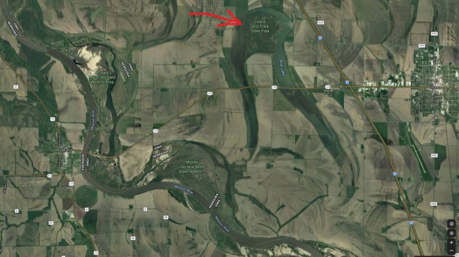
The Lewis and Clark State Park was created on the Blue Lake, which is an oxbow (U-shaped body of water) formed by the Missouri River years ago. Oxbow lakes are created when a wide curvy part of a river (a meander) cuts off to find a shorter course leaving behind a free-standing body of water or an oxbow. Lewis and Clark’s expedition came through here on August 10, 1804. The explorers stayed awhile and recorded several geological and biological observations.

The significance of Lewis and Clark’s expedition can never be understated. The impact it had on the evolution of the newly formed United States can fill a countless number of American history books. The expedition led by two very different men assisted by a Shoshone Indian woman forever altered the U.S. government’s relationship with American Natives, opened up America’s westward expansion of white settlers, created accurate topographical maps of the northwest and contributed to scientific research with its contact with 70 American Native tribes, and detailed descriptions of the geography and more than 200 new plant and animal species.
From their 8000-mile and 2-yr expedition, Lewis and Clark gave the Great Plains a face, a vast and harsh territory between the Missouri River and the ominous Rocky Mountains. The Loess Hills brought the Great Plains into focus during our stay at Lewis and Clark State Park. After that, we began our trek north and eventually west, the beginning of our journey into the Great Plains. From the time we left the state park, it took another day and a half before we crossed the Missouri River on I-90 and entered Mountain time. But, before we made the crossing, we had some art to view. Stay tuned.
RV Tips
Lewis and Clark SP is one of many parks we have stayed for several days without water or sewer hook-up. We prefer not to travel with much water in our fresh tank and will fill up at the campground before setting up. A little research (or a phone call) will let you know if potable water is easily available. It is typically located near the dump station as a separate water source (not the same water that is designated for flushing!). Some parks have additional potable water spigets scattered about the campground as well.

Another good read. Thanks for that.
>
LikeLike
Thanks for taking the time to read it! You’ll have more time this winter. 😉
LikeLike
Wow….not only are you an amazing photographer you are an amazing writer. I just woke up to a little trip I was not expexting. Vics dream is to RV a little across the country…me I worry about this color devide that still plagues this country of ours…but it might serve for great conversations between us all. I would do anything for her. I will share your beautiful blog with her. We hope to sell our home in March, April and retire. So whatever God has in store here we come. Much love to you both. Can’t wait to see you.
LikeLike
Lina, thank you so much, you are too kind! Viv and I have a lot of thoughts and insights into your valid concerns and would love to share them with you and Vic. Please, before we leave again next April, let’s arrange a day when you both can come visit us. We can help you make your RV and travel decisions. Best to you both and great to hear from you! Connie
PS, don’t hesitate to contact me or Vivian with questions.
LikeLike