
The Earth is old and wrinkled, and those wrinkles make the Earth look distinguished. The most prominent of them is in Utah. Earth’s crust has many “geologic wrinkles” where movement along a fault caused one side of the fault to shift vertically upward, creating a monocline or “step-up” in rock layers. Before all that happened though, sedimentary rock accumulated for hundreds of millions of years, forming distinctive layers that give evidence to time periods when rivers and swamps, deserts, and shallow oceans with tidal flats existed. Along the way, great tectonic forces uplifted these rock layers.


The Colorado Plateau is a quarter million square-mile region contained in Utah, Arizona, New Mexico and Colorado that was uplifted relatively evenly. This maintained the sedimentary layers in a horizontal position, such as what you see in the Grand Canyon. Those eye-catching buttes that make the American southwest so iconic are “erosional islands” among the once continuous plateau of horizontal rock layers. I’ll get back to the phenomenon of erosion later because it is the secret sauce of the southwest landscape that we come to admire, and it plays a large role in earth’s wrinkles.

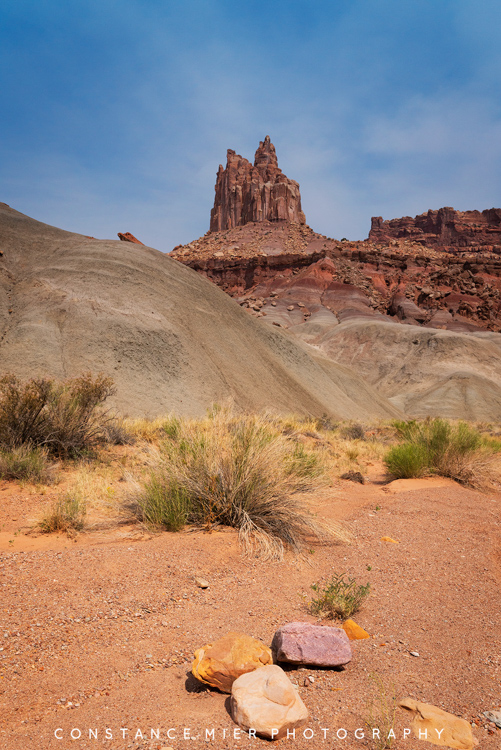
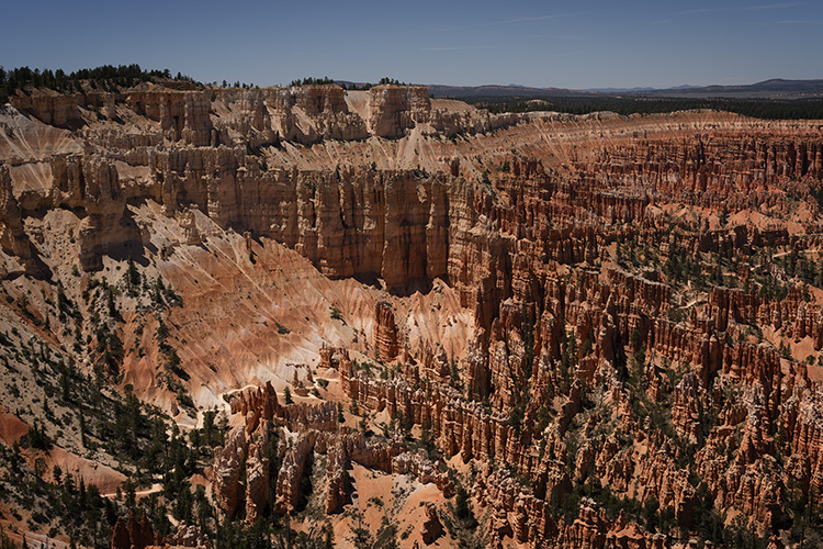
Somewhere in the Colorado Plateau is a grand exception to the horizontal layers of rocks. It is the Waterpocket Fold, a “100-mile-long warp in Earth’s crust”, and what the Navajo referred to as “Land of the Sleeping Rainbow”. About 50-70 million years ago, an ancient fault was reactivated causing movement in the earth’s crust. The west side of the fault shifted upward about 7,000 feet higher than the east side. Basically, the layer cake was tipped severely. It is a classic monocline, and this one is the largest of its kind on earth.


That wrinkle is what eventually caused the creation of Capitol Reef National Park. Remember what I said about erosion? If only one thing is learned from our time spent exploring New Mexico and Utah is that erosion is what makes this landscape stand out among all others. And we owe it all to water. Of course, deposition of sedimentary rocks over hundreds of millions of years and great shifts in tectonic plates are the basic ingredients, but erosion is the spice.
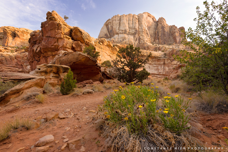
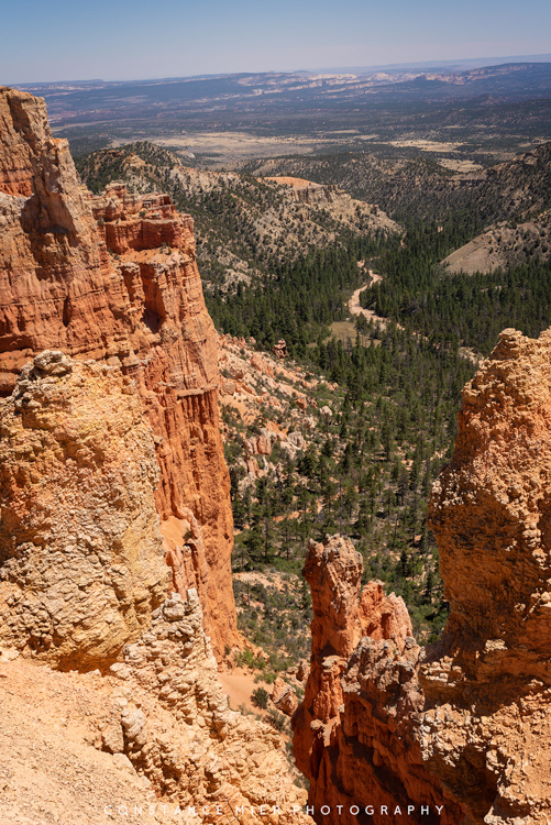
Capitol Reef National Park centers around the Waterpocket Fold. Waterpocket is the name given to the ongoing erosion of rock layers in the monocline, the small depressions in the sandstone layers formed by water. Those eroding tilted rock layers provide us “colorful cliffs, massive domes, soaring spires, stark monoliths, twisting canyons and graceful arches” to view in total amazement and wonder. It is erosion that inspires artists and explorers, and it is what inspires the creation of national parks.

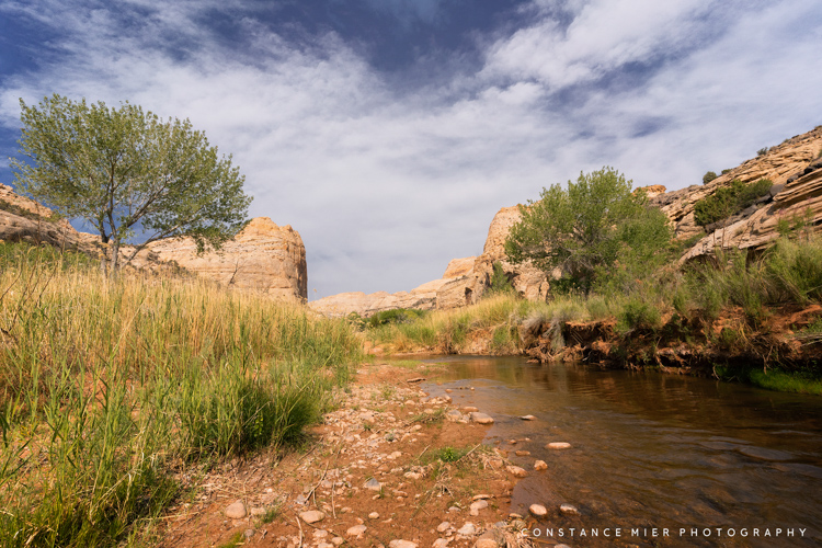
Water attracted farmers to the Waterpocket Fold, beginning with the ancestral Puebloan and Fremont people. Petroglyph panels provide beautiful evidence of the Fremont Culture, named from the river that flows through the park. Looking east, Mormon (Latter Day Saints) settlers exploring the high plateau west of what is now Capitol Reef saw water snaking through the cliffs and domes of the Waterpocket Fold. The original community called it Fremont River and where the river joined Sulphur Creek, established “the Eden of Wayne County”. In 1902, the name of the self-sufficient settlement was changed to Fruita, in recognition of the fruit orchards cultivated by the 10 or so families that made it their home. While much of the settlement is gone (a few buildings have been preserved), the orchards remain and visitors can pick fruit when in season or more easily purchase tasty fruit pies.


The Fruita residents were so proud of their little piece of heaven that in 1921 they organized a booster club to promote it. Local Ephraim Portman Pectol organized a nation-wide campaign to get the word out that he and his neighbors lived in paradise, many referred to as Wayne Wonderland. Pectol got elected to Utah’s legislature in 1933. He immediately contacted President Franklin D. Roosevelt and asked him to create “Wayne Wonderland National Monument”.


He must have been quite convincing and perhaps Roosevelt himself visited the Waterpocket Fold and did not require convincing because in 1938, he signed a proclamation to create Capitol Reef National Monument. The original name did not stick and for that I am relieved (does a Chevy Chase movie or a Mike Meyers character come to mind?). The name ‘Capitol Reef’ by the way came from the many large white Navajo sandstone domes that resemble many capitol buildings in the U.S. including the one in Washington D.C., and for the fact the ridge crust of the Waterpocket Fold presents a barrier to travelers, much like a reef in the ocean.
“Whereas certain public lands in the State of Utah contain narrow canyons displaying evidence of ancient sand dune deposits of unusual scientific value, and have situated thereon various other objects of geological and scientific interest; and Whereas it appears that it would be in the public interest to reserve such lands as a national monument, to be known as the Capitol Reef National Monument…”
-Proclamation No. 2246 on August 2, 1937, Page 136 by President Franklin D. Roosevelt
In 1971, Congress legislated an act to establish Capitol Reef National Park, signed into law on December 18, 1971 by President Nixon. And that is the story of how a wrinkle on earth became a 254,000-acre national park. Well played Earth.
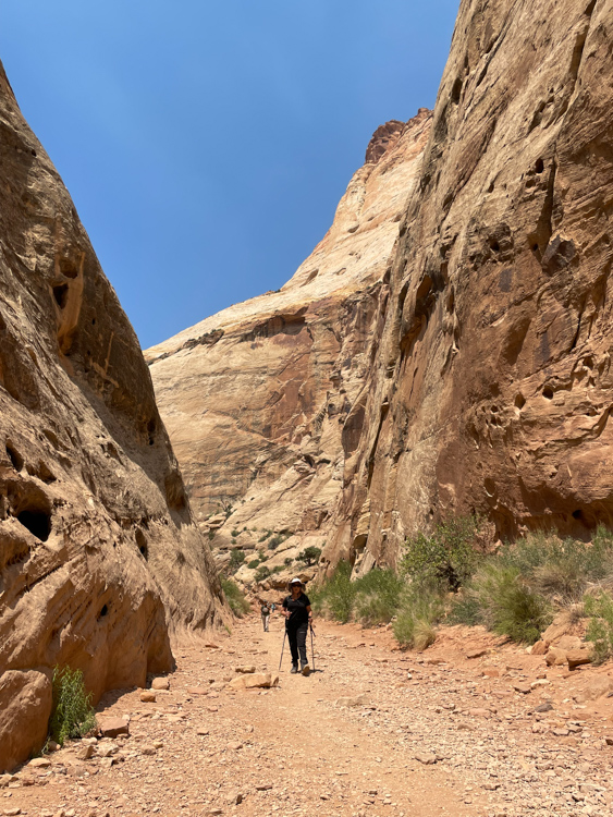
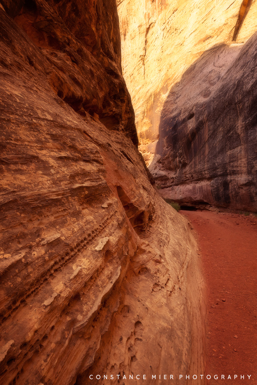
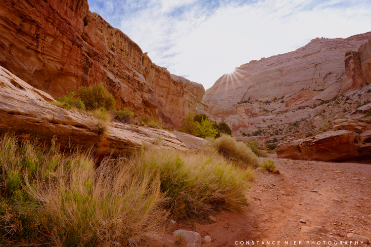
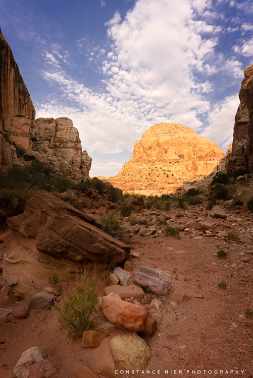
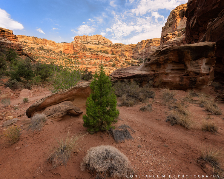
Enjoy this slideshow from my time spent in one of Capitol Reef’s canyons, the Grand Wash.


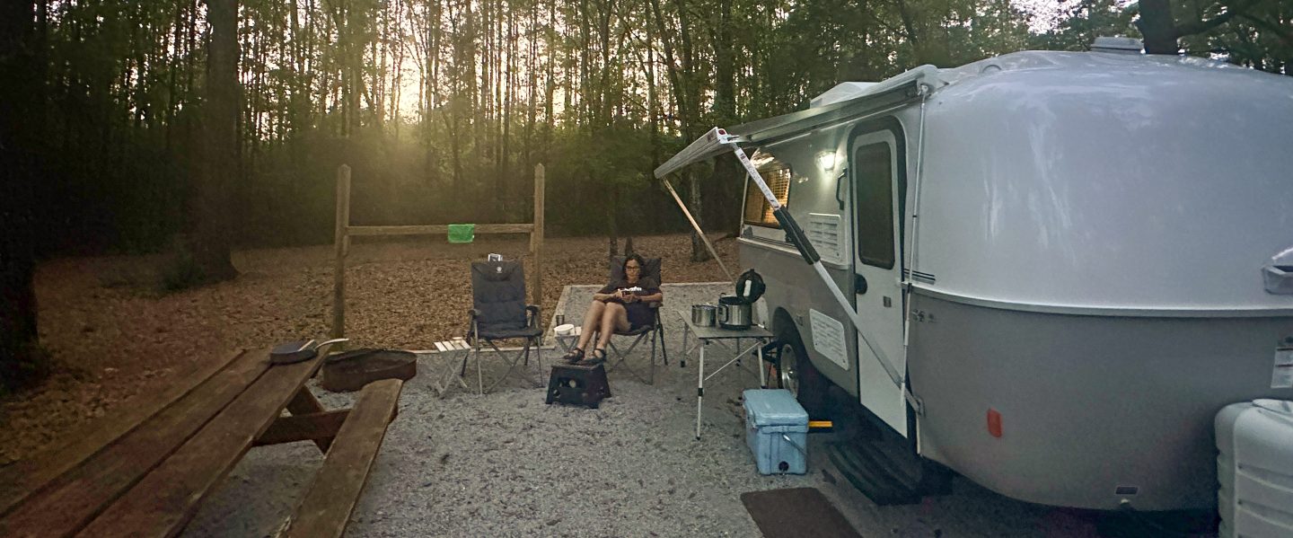
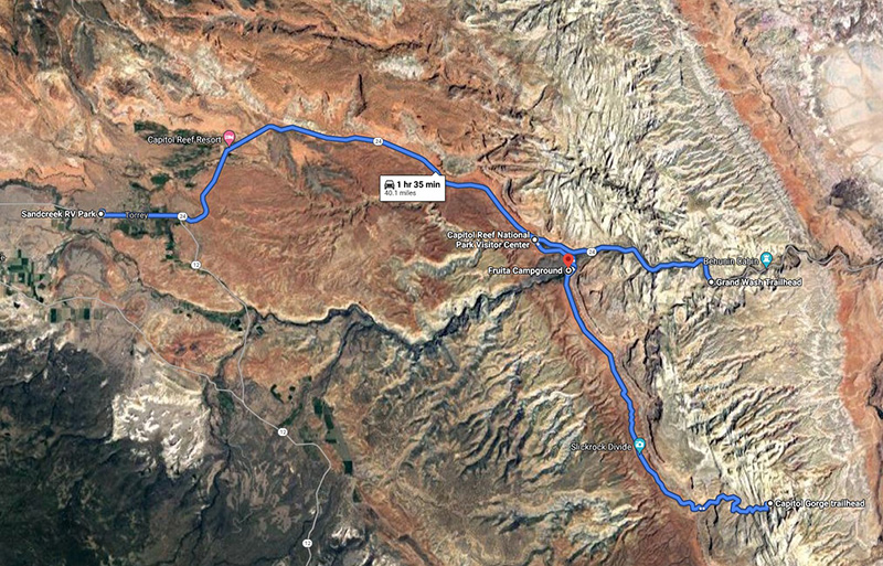
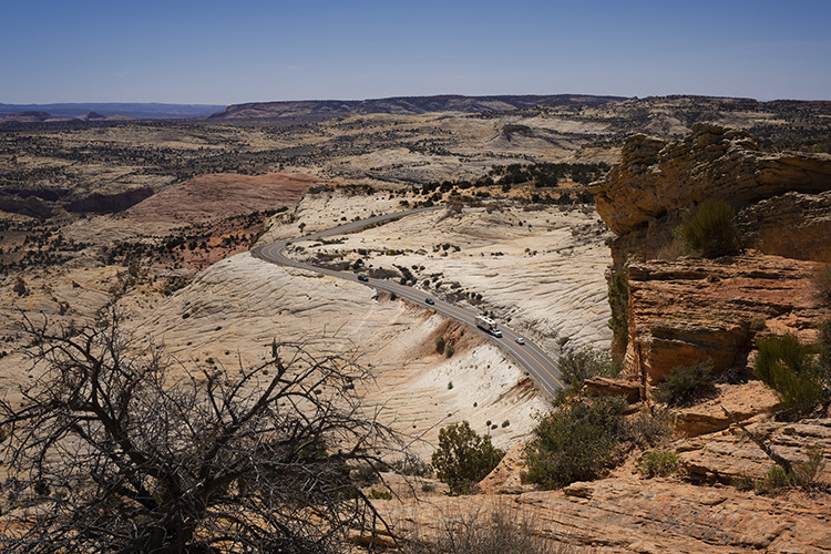
While staying in Torrey, we spent most of our time in Capitol Reef, but we did take one day to make a long scenic loop drive to continue exploring Utah.
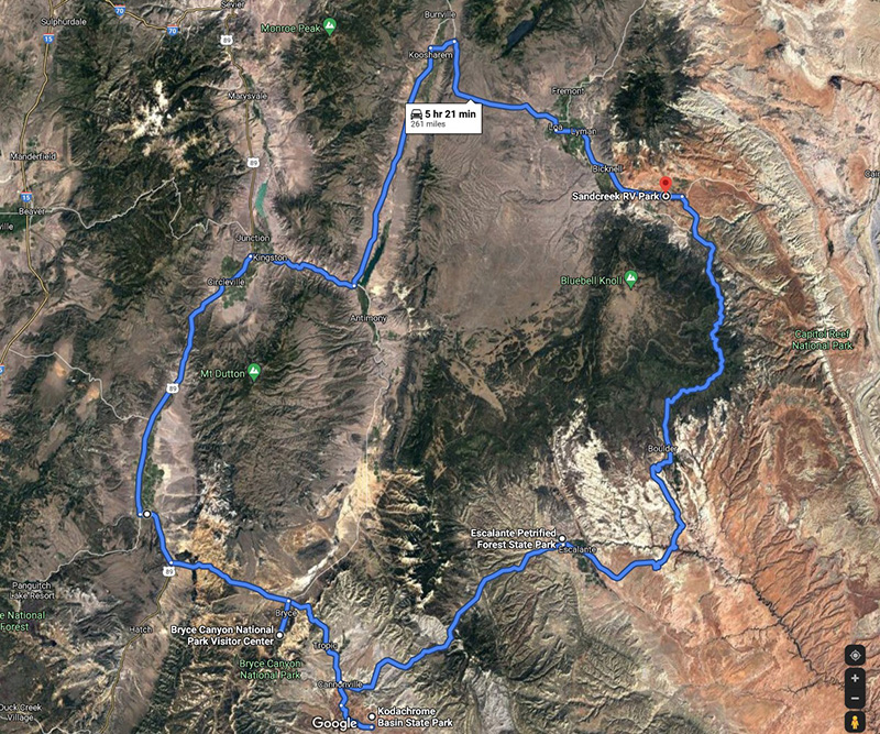
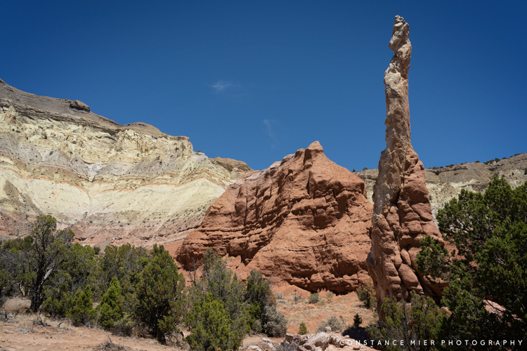
Enjoy this slideshow from our day trip.


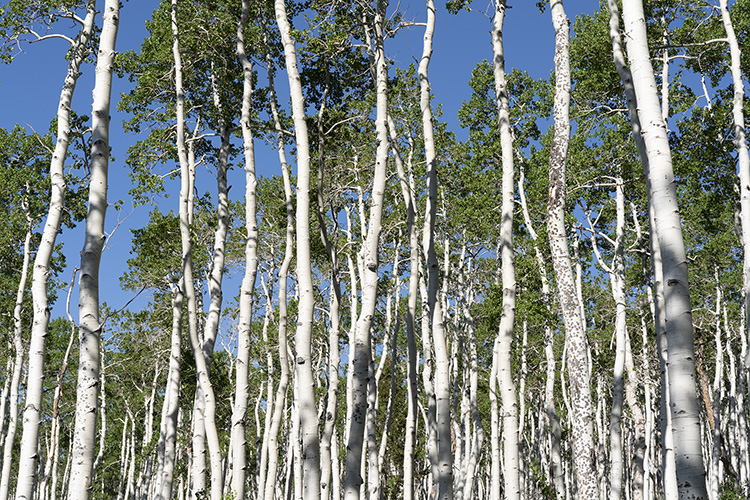
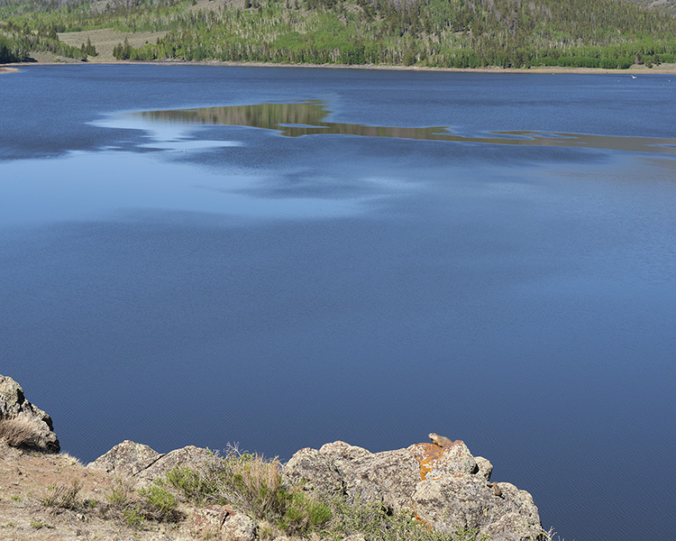
And we also took another day to explore the Fishlake area, northeast of Capitol Reef. It is there where we saw “The Trembling Giant”, also known as the “Pando”. And we saw our first marmot!


Wow, your pictures are amazing (as always)! Your blog takes me right back to when we visited three years ago. We came to appreciate nature’s “secret sauce” as well!
LikeLike
Thanks Spencer as always. I hope one day we can meet up somewhere in the southwest. We all seem to like being there very much!
LikeLike